 |
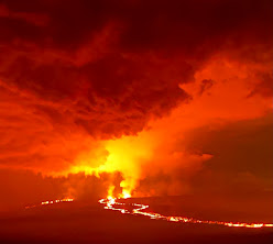
| View of the Mauna Loa eruption before dawn Tuesday morning from Hwy 11 between Pāhala and Volcano at Mile Marker 34. Photo by Tanya Ibarra |
KAPĀPALA FOREST RESERVE AND 'ĀINAPŌ TRAIL AND CABIN ARE CLOSED to the public. State Department of Land & Natural Resources made the announcement Monday night, following closure of Mauna Loa Forest Reserve and Kipuka ‘Ainahou Nēnē Sanctuary for at least 90 days. Division of Forestry & Wildlife Hawai‘i Island Branch manager Steve Bergfeld has the discretion to close additional areas impacted by the ongoing Mauna Loa eruption, as needed. He also closed Unit J of the Kapāpala Game Management Area. "No one should be accessing Mauna Loa at this time. Our sole focus is on public safety, which depends on where lava ultimately flows,” said Bergfeld.
.heic) |
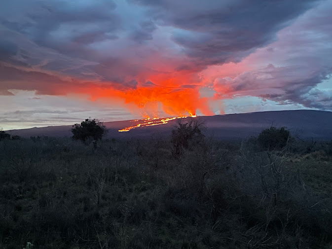
| Lava flow view from Saddle Road Tuesday night. Photo by Sarah de Silva |
On Monday, officers from Hawai'i Police Department and DLNR Division of Conservation & Resources Enforcement set up and began manning a roadblock at the intersection of Daniel K. Inouye Highway (Saddle Road) and Mauna Loa Observatory Access Road. Above the roadblock, on Monday, Bergfeld got a glimpse of the lava flow which he estimated at about one-mile-long. Lava appeared to be flowing slowly from the mountain’s caldera, which is continuing to send large plumes of gas and ash high into the sky. Much of the 50,000-acre Mauna Loa Forest Reserve is covered in lava from previous eruptions. Later Monday evening, the lava crossed the Mauna Loa Observatory Access Road.
On Tuesday, the state announced its plan to close the section of Saddle Road from above Kaumana in Hilo toward the Mauna Loa Observatory access road, should the lava continue to approach Saddle Road, possibly as early as Wednesday. By Tuesday afternoon, USGS reported the flow about 4.5 miles from
.jpg) |
| Forest Reserves are closed to the public around the Mauna Loa Lava Flow from Saddle Road to Ka'u. Photo by Zach |
USGS also announced new webcam views of the Northeast Rift Zone of Mauna Loa at: https://
www.usgs.gov/media/webcams/m5cam-mauna-loa-fissure-3-eruption-northeast-rift-zone
https://www.usgs.gov/media/webcams/m6cam-mauna-loa-northeast-rift-zone-uprift-view-wswhttps://www.usgs.gov/media/webcams/m4cam-mauna-loa-northeast-rift-zone-downrift-view-ene
To read comments, add your own, and like this story, see www.facebook.com/kaucalendar. See latest print edition at wwwkaucalendar.com. See upcoming events at https://kaunewsbriefs.blogspot.com/2022/04/upcoming-events-for-kau-and-volcano.html.
THE MILOLI'I CIVIL DEFENSE MEETING IS CANCELLED for this Saturday, Dec. 3. It was designed to update and talk story with the community on the possible eruption of Mauna Loa. Now that the eruption is ongoing and on the other side of the island, the Miloli'i meeting has been delayed, according to Hawai'i County Civil Defense.
 |
| USGS photo taken from Saddle Road on Tuesday shows lava flows moving northeast downslope of Mauna Loa from the Northeast Rift Zone eruption. USGS photo by David Free |
AN EMERGENCY PROCLAMATION BY THE GOVERNOR HAS BEEN ISSUED. Gov. David Ige said: "We're thankful the lava flow is not affecting residential areas at this time, allowing schools and businesses to remain open. I'm issuing this Emergency Proclamation now to allow responders to respond quickly or limit access, if necessary, as the eruption continues."
The disaster relief period is in effect through Jan. 27, 2023, unless terminated or superseded by separate proclamation.
Hawaiʻi Department of Health is advising the public, particularly on the northeast side of the island and across the channel to Maui, to be prepared for air quality impacts due to the Mauna Loa eruption. DOH noted that COVID face masks like KN95s do NOT provide protection from sulfur dioxide or vog. However, they can help reduce inhaled hazardous particulates such as falling ash and Pele's hair, when walking outside.
The governor also noted that flights to Hawaiʻi Island resumed their normal schedule: "Hawaiʻi Island is open to visitors, and it is safe to view the volcano from a distance. Please respect our community and avoid closed areas, residential neighborhoods, and no parking zones."
Roadside parking is prohibited along much of the Daniel K. Inouye Highway because of the danger from high-speed traffic. Parking is permitted only in designated areas and illegally parked vehicles may be ticketed or towed to protect public safety. The road is expected to be closed between upper Kaumana and the Mauna Loa Observatory access road as early as Wednesday, as the lava approaches the highway.
.jpg)


.jpg)


