 |
| Waikapuna is subject of a community planning meeting via Zoom on Wednesday, Jan. 26. Photo by Shalan Crysdale |
THE LAND MANAGEMENT PLAN FOR WAIKAPUNA IS OPEN FOR PUBLIC INPUT. Those assisting the community in making the plan sent out a notice this week to remind folks that a community meeting will be on Wednesday, Jan. 26 at 6:30 p.m. "to provide mana'o about the important cultural and natural resources of Waikapuna, critical issues relating to the resources, and ideas for stewardship." 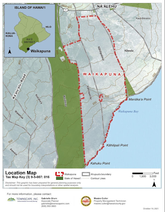
Waikapuna is 2,317 acres, located south of Nāʻālehu in the ahupua'a of Kahailipalinui and Kahilipali'iki in the moku of Kaʻū. Several developments have been proposed for this land, the most recent being a subdivision development planned by the previous landowner.
Townscape, a consulting firm, is contracted to help make the plan with community input. Analysis of Waikapuna resources, issues and needs was done during the third quarter of 2022. Next step is to develop management strategies by the second quarter of 2022 and to complete the Final Waikapuna Management Plan by the fourth quarter of 2022. In addition to the community meeting by zoom on Jan. 26, there will be a community meeting regarding the Draft Waikapuna Management Plan during the third quarter of 2022.
The Jan. 26 meeting is begin held on Zoom, due to ongoing health concerns regarding COVID-19. The Meeting ID is 837 4467 8871. Passcode is kau. For audio only, dial (346) 248-7799
Meeting ID: 837 4467 887. Passcode : 816026.
The east, or Mauna Loa Cabin apron, is also dominated by ponded lava ejecta, both unaltered and altered. We documented over 1,700 clasts, and ponded lava comprises 98 percent of the lithics, while pāhoehoe clasts, both unaltered and altered, comprise only about 1 percent of the deposit. Bread-crust or crackle-surfaced rocks also comprise 1 percent of this deposit, along with a single gabbroic lapillus that was noted. Map of explosive deposits at the edge of Moku'āweoweo, the summit caldera of Mauna Loa. Map showing the size distribution of ejecta, sorted by maximum length in centimeters (one inch is about 2.5 cm). The colors indicate the different size fractions in centimeters. The largest blocks were found closest to the rim. In general, clast size diminished with increasing distance, but medium-sized blocks were found nearly at the distal extent of fan limits. The dark flows in the image outside the caldera are the youngest 'a'ā flows. USGS map.
Surprisingly, the two most uncommon rocks in the other explosive fans are quite abundant in the west fan. Gabbros comprise 21 percent of the deposit, while bread-crust or crackled-surface rocks comprise 11 percent of the deposit.
The flow samples indicate the explosions occurred at depth, and had to break through overlying lava flows. Many of the pahoehoe blocks are rounded, suggesting that they were tumbled in the vent or recycled a few times before ejection. Gabbros represent crystalized lava lake. The most unusual blocks have "bread-crust" textures or have water-quenched-type outer surfaces (crackled). We interpret the bread-crust-textured clasts as the ejected clots of residual melts of crystallizing shallow magma bodies, similar to those that produced the gabbroic xenoliths. This residual melt was still molten or plastic when the explosive activity occurred. In contrast, the crackle-surfaced types are the result of hot rocks being rapidly quenched.

Waikapuna is 2,317 acres, located south of Nāʻālehu in the ahupua'a of Kahailipalinui and Kahilipali'iki in the moku of Kaʻū. Several developments have been proposed for this land, the most recent being a subdivision development planned by the previous landowner.
Seeking to protect its significant natural and cultural resources, the Ala Kahakai Trail Association, a non-profit organization, raised funds through The Trust for Public Land; the State Legacy Land Conservation Program; County of Hawai'i's Public access, Open Space and Natural Resources Preservation Fund; and private doors to acquire Waikapuna for conservation in 2019.
County of Hawai'i holds a Conservation Easement over Waikapuna with the purpose to "conserve, preserve, and protect in perpetuity the historic, cultural, agricultural, natural, marine, scenic, open space, fresh water, and native and endemic plant and animal habitat values of the Easement Property." A conservation easement is a legal agreement that permanently limits uses of the land (such as development) in order to protect its conservation values.
Ala Kahakai Trail Association, which holds title to the property, is required to establish a land management plan that is consistent with the purpose of the Waikapuna Conservation Easement and the State LLCP grant agreement.
 |
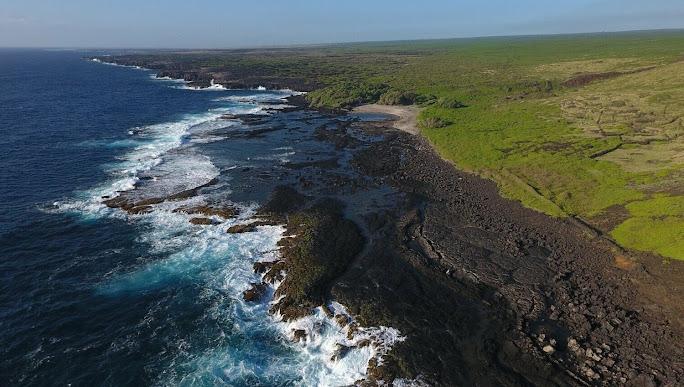
| Waikapuna's coastline is home to an intricate network of flora and fauna. Photo from Ala Kahakai Trail Association |
The Jan. 26 meeting is begin held on Zoom, due to ongoing health concerns regarding COVID-19. The Meeting ID is 837 4467 8871. Passcode is kau. For audio only, dial (346) 248-7799
Meeting ID: 837 4467 887. Passcode : 816026.
To read comments, add your own, and like this story, see www.facebook.com/kaucalendar/. See latest print edition at www.kaucalendar.com.
MAUNA LOA'S EFFUSIVE ERUPTIONS AND SPECTACULAR LAVA FLOWS are the subject of this week's Volcano Watch, written by USGS Hawaiian Volcano Observatory scientists and affiliates:
Mauna Loa is known for its effusive eruptions that produce spectacular lava flows. However, some of the volcanic products found on Mauna Loa are pyroclastic or explosive in character.
Evidence of a more violent style of eruption has been identified in the form of debris fans. These deposits are largely made up of solidified blocks, lapilli (pieces <2.5 inches), and ash.
Evidence of a more violent style of eruption has been identified in the form of debris fans. These deposits are largely made up of solidified blocks, lapilli (pieces <2.5 inches), and ash.
The age and general location of the deposits were discussed in an earlierVolcano Watch article published in 2018. Here, we describe the rock types and sizes, which are used to help constrain the vent locations and size of these unusual explosive eruptions.
Generally, the ejected rocks are roughly equivalent in size and abundance along the central axis of each fan, and they decrease in size with increasing distance from the caldera rim. We documented over 1,000 clasts from the debris fan on the northwest rim. The clasts were dominated by ponded lava, ejecta, both unaltered and altered, totaling 78 percent. Pāhoehoe clasts, both unaltered and altered, are the second most abundant, at 20 percent, while gabbroic xenoliths and bread-crust or crackle-surface rocks each comprise 1 percent of the deposit. Clasts in the northwest fan range in size from 3–220 cm (1–87 in) in diameter, with an average size of 26 cm (10 in).
 |
Types of explosive clasts found in the debris fan deposits at the summit of Mauna Loa: (A) unaltered pondedlavaflow, (B) unaltered pāhoehoe, (C) altered ponded lava flow, often has a red to pink hue, (D) thermally altered pāhoehoe, often has a red-to-pink hue, (E) gabbroic xenolith, the most crystalline rocks we found, (F) bread-crustouter surfaces and vesicular interiors or dense clasts with crackle or crazed surface rinds, (G) bread-crust due to quenching. USGS photos |
In the east fan, most larger-sized clasts (greater than 40 cm or 16 in) are found in the northern section of the fan. Lithic ejecta in the north ranges from 2–153 cm (0.8–60 in) in length, with an average of 21 cm (8 in). To the south, the clasts are much smaller and more abundant. The ash fraction is over 70 percent of the deposit, burying almost all of the underlying pāhoehoe flows. The clasts range in size from 1–66 cm (0.4–26 in), with an average size of 13 cm (5 in).
West fan clasts, types, and sizes are randomly scattered at varying distances from the caldera rim, with no clear dispersal pattern. We cataloged over 340 clasts; pāhoehoe, both unaltered and altered, is the most abundant at 44 percent, followed by ponded lava, both unaltered and altered, at 24 percent. Clasts range from 2–90 cm (0.8–35 in), with an average of 20 cm (8 in).
West fan clasts, types, and sizes are randomly scattered at varying distances from the caldera rim, with no clear dispersal pattern. We cataloged over 340 clasts; pāhoehoe, both unaltered and altered, is the most abundant at 44 percent, followed by ponded lava, both unaltered and altered, at 24 percent. Clasts range from 2–90 cm (0.8–35 in), with an average of 20 cm (8 in).
Map of explosive deposits at the edge of Moku'āweoweo, the summit caldera of Mauna Loa. Map showing the size distribution of ejecta, sorted by maximum length in centimeters (one inch is about 2.5 cm). The colors indicate the different size fractions in centimeters. The largest blocks were found closest to the rim. In general, clast size diminished with increasing distance, but medium-sized blocks were found nearly at the distal extent of fan limits. The dark flows in the image outside the caldera are the youngest 'a'ā flows. USGS map.Surprisingly, the two most uncommon rocks in the other explosive fans are quite abundant in the west fan. Gabbros comprise 21 percent of the deposit, while bread-crust or crackled-surface rocks comprise 11 percent of the deposit.
The flow samples indicate the explosions occurred at depth, and had to break through overlying lava flows. Many of the pahoehoe blocks are rounded, suggesting that they were tumbled in the vent or recycled a few times before ejection. Gabbros represent crystalized lava lake. The most unusual blocks have "bread-crust" textures or have water-quenched-type outer surfaces (crackled). We interpret the bread-crust-textured clasts as the ejected clots of residual melts of crystallizing shallow magma bodies, similar to those that produced the gabbroic xenoliths. This residual melt was still molten or plastic when the explosive activity occurred. In contrast, the crackle-surfaced types are the result of hot rocks being rapidly quenched.
So why is this information so important? Based on simple geometry of the arcuate shaped deposit fans, clast type, and size distribution, we can determine that the sources of these explosive eruptions were from vents on the caldera floor adjacent to the deposits found on the rim.
We know that explosive eruptions have occurred on Mauna Loa before, and that this type of activity is likely to happen again. Although no one lives at the summit of Mauna Loa, explosive eruptions have the potential to pose a threat to hikers, aircraft, and communities downwind that could experience ashfall. This study adds another important dimension in reconstructing the long-term eruptive history of Mauna Loa.
To read comments, add your own, and like this story, see www.facebook.com/kaucalendar/. See latest print edition at www.kaucalendar.com.
 |
| See archives of The Ka`u Calendar at www.kaucalendar.com and find the monthly print copy in mailboxes from Volcano through Ocean View. |