 |
| `Imi Pono No Ka `Aina helped during a Hawai`i Wildlife Fund cleanup of anchialine ponds near the coast of Wai'ohinu. Photo from Megan Lamson |
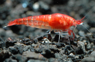 |
| Opae'ula, one of the native species living in anchialine ponds. Photo from The Nature Conservancy. |
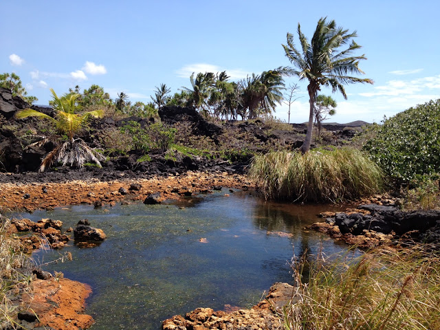 |
| Kanonone Waterhole at Pohue Bay is an anchialine pond that hosts endemic and native species. Photo by Shalan Crysdale |
First hint: most people who know the name probably don't know it refers to a volcano. Second hint: where do many people think Noah's Ark landed when the Biblical Great Flood receded?The answer is Mount Ararat, a volcano that rises to an elevation of 5,137 m (16,854 ft) and towers over the Armenian Highlands in eastern Turkey near its borders with Iran and Armenia. A small glacier caps the mountain and is currently melting. The volcano dominates the skyline as seen from Yerevan (population 1.1 million), the capital city of Armenia some 65 km (40 miles) away and 4 km (2 miles) lower, and it has long been a cultural icon for Armenians.
Mount Ararat comprises two large cones 13 km (8 miles) apart, Greater and Lesser Ararat. Greater Ararat, the western of the two cones, is about 25 km (16 miles) wide and rises some 3 km (1.9 miles) above its surroundings. It is separated from Lesser Ararat (3,896 m or 12,782 ft high and 15 km or 9 miles wide) by a large north-south fault; many smaller cones and lava domes erupted along this fault and on the flanks of the two larger cones.

Greater Ararat remains volcanically active. It last erupted on July 2, 1840, when a pyroclastic flow issued from radial fissures high on its northern flank, accompanied by a phreatic explosion.
Unconfirmed eruptions may have occurred in CE 1783 and 1450. Oral traditions recount an eruption in about 550 BCE.
Could an eruption of Mount Ararat have covered or burned away Noah's Ark, assuming, for the sake of argument, that the ark existed? The eruptive history of the past 4500 years allows this remote possibility, but since we don't know the age of the ark, the question is moot.
Biblical scholars emphasize that the Hebrew of Genesis 8:4 refers to "mountains of Ararat." Postbiblical tradition assigns the location of ark landing to Mount Ararat itself, but the name Urartu (the cognate of the Hebrew Ararat) was the name of a much wider region that happens to contain Mount Ararat. Were volcanoes other than Mount Ararat active in Urartu?
 |
| A structure claimed to be Noah's Ark on the broad shield volcano called Tendurek near Mount Arawat, Turkey. Photo from Wikipedia |
At the southwest end of Lake Van is the well-known Nemrut volcano, with a summit caldera and, according to the Smithsonian Institution's Global Volcanism Program, 10 confirmed eruptions in the past 6,000 years. Other volcanoes, such as Suphan, also occur between Mount Ararat and Lake Van but are reportedly a little older than those mentioned.
The Mesopotamian "Epic of Gilgamesh" also describes a huge flood, probably some 4500-5000 years ago along the Tigris and(or) Euphrates Rivers, which drain much of the area containing these active volcanoes. Some scholars speculate that the Gilgamesh and Biblical floods are the same. Such speculation can probably never be more than just that, but the possibility that an eruption in Urartu dammed a river and led to a massive flood when the dam failed may be one element of speculation that is reasonable geologically.
Whether or when the great floods of Noah and Gilgamesh actually happened may never be known. A remote possibility overlooked in most discussions about these canonical events, however, is that volcanic activity could have played a role.
To read comments, add your own, and like this story, see www.facebook.com/kaucalendar/. See latest print edition at www.kaucalendar.com. See upcoming events and Kaʻū Calendar newspaper sponsors at http://kaunewsbriefs.blogspot.com/2022/02/events-of-february-2022.html.
To read comments, add your own, and like this story, see www.facebook.com/kaucalendar/. See latest print edition at www.kaucalendar.com. See upcoming events and Kaʻū Calendar newspaper sponsors at http://kaunewsbriefs.blogspot.com/2022/02/events-of-february-2022.html.
YOUNG WOMEN IN PUBLIC AFFAIRS AWARD offered by Zonta Club of Hilo. Deadline to apply is March 1. Open to women ages 16-19 interested in careers in public policy making, government, and volunteer organizations. For more details, visit zontahilo.org/scholarships-grants/.
SEE MORE CALENDAR OF EVENTS & SPONSORS