 |
| Tropical Storm Hone chugged along a path south of Hawai'i Island on Saturday, sending steady rain and bands of rain onto the island overnight. Photo from NOAA |
The center of tropical storm Hone was about 110 miles SSE OF Hilo at 7:10 p.m., according to Central Pacific Hurricane Center. Rain from the storm was already on island. The maximum sustained winds offshore at the center of the storm were 65 mph, but winds were expected to extend onto the island as the storm passes south of South Point overnight.
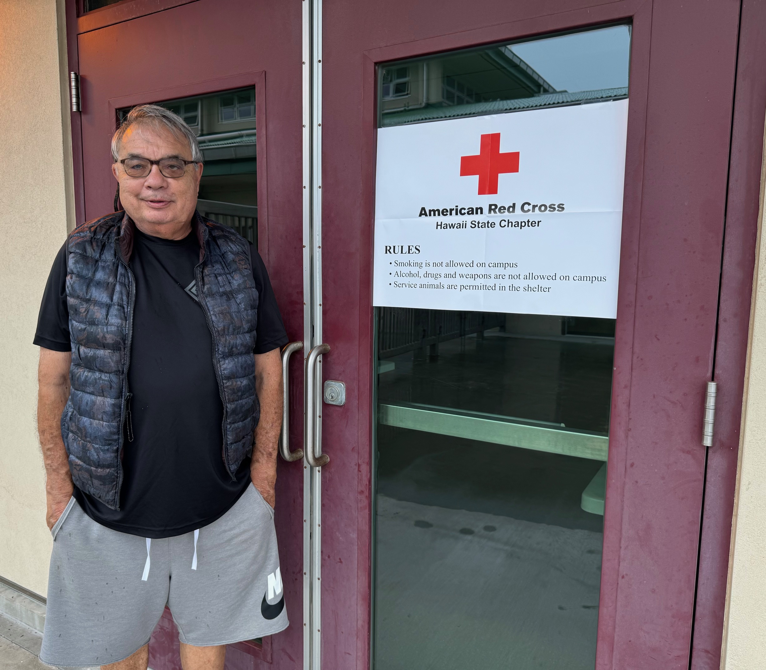 |
| Glenn Kokubun maned the county/Red Cross shelter in the auxiliary room to Kaʻū Herkes District Gym. Na'alehu Elementary School cafeteria was also opened as a shelter. Photo by Julia Neal |
Some Hele On Bus Routes were cancelled as were all one way flights from Honolulu to Hilo Airport.
The County cancelled all overnight camping at Whittington and Punalu'u Beach Parks, followed by closing all county beach parks islandwide. The County opened shelters at Herkes Kaʻū District Gym and Nāʻālehu Elementary School Cafeteria.
COASTAL AND MAUNA LOA SUMMIT BACKCOUNTRY HIKING AND CAMPING is prohibited in Hawai'i Volcanoes National Park until further notice. The Park made the announcement Saturday morning in light of the National Weather Service issuing a Tropical Storm Warning for Hawaiʻi Island.
COASTAL AND MAUNA LOA SUMMIT BACKCOUNTRY HIKING AND CAMPING is prohibited in Hawai'i Volcanoes National Park until further notice. The Park made the announcement Saturday morning in light of the National Weather Service issuing a Tropical Storm Warning for Hawaiʻi Island.
"Because this includes a possibility of tropical storm force winds, Hawaiʻi Volcanoes National Park has closed the coastal and Mauna Loa summit backcountry areas to both day hiking and overnight camping.
"The park will continue to monitor the storm conditions and any damage that follows and will reopen the backcountry when it is safe to do so. Park visitors are urged to check the weather https://www.nhc.noaa.gov/?cpac and the park website for any closure or hazard alerts at www.nps.gov/hawaiivolcanoes.
"The park will continue to monitor the storm conditions and any damage that follows and will reopen the backcountry when it is safe to do so. Park visitors are urged to check the weather https://www.nhc.noaa.gov/?cpac and the park website for any closure or hazard alerts at www.nps.gov/hawaiivolcanoes.
To read comments, add your own, and like this story, see facebook.com/kaucalendar. See upcoming events, print edition and archive at kaunews.com. Support this news service with advertising at kaunews.com. 7,500 copies in the mail and on stands.
.jpg) |
| Trojans Football Roster |
"The Trojan team is really disappointed but looks forward to next weekend's game and a rematch with Pahoa," said Guerpo.
The game was to have been the launch of the expanded Trojan cheerleading squad, which numbers more than 20. It is under the direction of Carma Hanshew.
To read comments, add your own, and like this story, see facebook.com/kaucalendar. See upcoming events, print edition and archive at kaunews.com. Support this news service with advertising at kaunews.com. 7,500 copies in the mail and on stands.

VOLCANIC TREMOR OR DISTANT EARTHQUAKE? That's the title of this week's Volcano Watch written by U.S. Geological Survey Hawaiian Volcano Observatory scientists and affiliates:
The Island of Hawaiʻi is one of the most seismically active areas in the world, producing thousands of earthquakes every year. It also commonly produces a signal called tremor that can originate from the volcanic system.
Tremor is characterized by slowly emerging seismic waves which may last for minutes to many days when there are ongoing eruptions. It is important to identify tremor because this signal can be associated with fluid movement, which can sometimes indicate an increased chance of eruption. However, tremor is often difficult to locate because the waves slowly emerge from the background noise and can persist for minutes to weeks or even years—shallow tremor at Kīlauea or Mauna Loa is often directly associated with ongoing eruptive activity.
 |
| Example waveforms showing a T-phase arriving from the M7.4 Chile earthquake on July 19, 2024 (left). This T-phase event is compared to a local tremor burst deep beneath Pāhala on July 30, 2024 (right). The plots show time for several stations in the HVO network. The T-phase moves more slowly across the network which is represented by systematic delays in the time from the top to the bottom of the left plots on the figure. The plots on the right side of the figure shows the waveforms coming in at about the same time on several stations; this occurs because the Pāhala event is deeper beneath the volcano. USGS image |
In contrast, earthquakes usually have sharp onsets which are easy to see. The time that an earthquake signal appears at the many stations that make up the USGS Hawaiian Volcano Observatory (HVO) seismic network can be used to find the earthquake's location. Instead, the location for tremor bursts is often estimated by looking at the signal size (or seismic amplitude) at multiple seismic stations and then determining the approximate position and depth.
As an example, shallow tremor bursts at Mauna Loa summit might have strong seismic amplitudes at stations near the summit of Mauna Loa, but very weak signals by the time the signal arrives at the Kīlauea seismic stations. By contrast, a tremor burst deep below Pāhala may have almost the same seismic amplitudes on several stations near Pāhala, and only to become weak at seismic stations in Kona, or Hilo.
 |
| Permanent seismic stations and temporary nodal locations keep track of activity in Ka'u. USGS map |
This earthquake also produced a strong hydroacoustic signal (a sound wave traveling through water)— called the T-phase—which was recorded throughout the Pacific basin. T-phases are very different from a tsunami wave and are not hazardous to people. They move at a speed of almost 1.5 kilometers per second (about 3,355 mph) and so would take just under 2 hours to get from Chile to the State of Hawai'i.
In this case the wave is transmitted through the ocean predominantly within a horizonal layer called the Sound Fixing and Ranging (SOFAR) channel, which tends to efficiently trap or guide hydroacoustic sound waves. When the T-phase reaches the coast in the State of Hawaii, its energy is converted back into a seismic signal that looks remarkably like local volcanic tremor on the HVO seismic network.
Because HVO is always vigilantly monitoring seismic signals, HVO scientists often need to distinguish between local volcanic tremor and the T-phase from a distant earthquake. The figure here shows an example of local tremor burst deep beneath Pāhala at 4:13 p.m. HST on July 30, 2024. By comparing this local tremor burst to the earlier T-phase event from Chile on July 19, we see that the T-phase event has arrivals that are spread out in time across the HVO seismic network—a result of the slower speed of the acoustic waves in the water. By contrast, the deep volcanic tremor beneath Pāhala arrives at the different HVO stations at about the same time—a result of the local source and faster wave speeds found for basaltic rocks.
HVO scientists can distinguish local tremors from distant earthquakes by assessing arrival times for signals and evaluating their amplitudes. They can further confirm that the observed signal is a T-phase by looking for large events in the global earthquake catalog. This seismic sleuthing is one of the many facets of volcano monitoring in Hawai'i.
Volcano Activity Updates
Kīlauea is not erupting. Its USGS Volcano Alert level is ADVISORY. Seismic activity and ground deformation continues at Kīlauea's summit and upper-to-middle East Rift Zone, with another intrusive event near Pauahi Crater from August 19-20. Over the week ending Thursday, about 800 earthquakes were detected beneath Kīlauea's upper East Rift Zone and about 100 events were detected between Maunaulu and Puʻuʻōʻō in the middle portion of the East Rift Zone within Hawaiʻi Volcanoes National Park. Over the past week, Kīlauea's summit and middle East Rift Zone showed slow inflation, followed by slow deflation during the intrusive event. Since then, there has been relatively little ground deformation

Mauna Loa is not erupting. Its USGS Volcano Alert Level is at NORMAL.
Fourteen earthquakes were reported felt in the Hawaiian Islands during the week ending Thursday, Those above magnitude-3 were: a M4.7 earthquake 15 km (9 mi) S of Fern Forest at 6 km (4 mi) depth on August 22 at 12:52 a.m. HST, a M3.4 earthquake 6 km (3 mi) S of Volcano at 0 km (0 mi) depth on August 20 at 9:22 a.m. HST, a M3.2 earthquake 8 km (4 mi) S of Volcano at 0 km (0 mi) depth on August 20 at 7:22 a.m. HST, a M3.8 earthquake 11 km (6 mi) NE of Pāhala at 31 km (19 mi) depth on August 20 at 5:32 a.m. HST, a M3.9 earthquake 30 km (18 mi) WNW of Hawaiian Ocean View at 11 km (7 mi) depth on August 20 at 3:52 a.m. HST, and a M3.2 earthquake 6 km (3 mi) S of Volcano at 1 km (0 mi) depth on August 20 at 2:46 a.m. HST.


.jpeg)


To read comments, add your own, and like this story, see facebook.com/kaucalendar. See upcoming events, print edition and archive at kaunews.com. Support this news service with advertising at kaunews.com. 7,500 copies in the mail and on stands.


.jpeg)

