About The Kaʻū Calendar

Sunday, March 03, 2024

Kaʻū News Briefs March 3, 2024

The Planning Department's report refers to coconut trees at Punalu‘u as cultural resources in its analysis of the 
Black Sand Beach, LLC Punalu‘u development plan up for public hearing this Thursday. Photo by Ophir Danenberg

REGARDING THE PUBLIC HEARING ON PUNALU‘U, COUNTY COUNCIL MEMBER MICHELLE 
County Councilmember Michelle Galimba
GALIMBA IS SENDING OUT REMINDERS that the public can participate by Zoom at Nāʻālehu Community Center on Thursday, March 7. Her notice says: 
    "Public testimony to the Windward Planning Commission (WPC) on the SMA permit application for a 225-unit development at Punaluʻu by Black Sands LLC will be available at the Nāʻālehu Community Center on March 7, 2024, beginning at 9 a.m.
    This will allow those in who do not wish to travel to Hilo for the in-person meeting of the WPC at the County Council Chambers at the County Building and who do not wish to sign up for an individual Zoom link to still provide testimony on the SMA permit application."
    Staff from the office of Councilmember Michelle Galimba will be at the Nāʻālehu Community Center to help community members to provide testimony to the Commission via a Zoom link to the WPC. The agenda for the WPC meeting is available at https://records.hawaiicounty.gov/WebLink/1/edoc/128532/2024-03-07%20Planning%20Commission%20Agenda.pdf?fbclid=IwAR2lOoatZq9Gve0dp7fbt31Y_oOp_e5QSbbiD5pqAn1TQR_bk_tpOiT7VCo
    The Black Sands LLC SMA application is available at

THIS IS THE FOURTH AND FINAL INSTALLMENT OF COUNTY PLANNING DIRECTOR ZENDO KERN'S REPORT ON THE PUNALU‘U DEVELOPMENT PROPOSAL for a Special Management Area permit. The report was released ahead of this Thursday's March 7 public hearing before the Windward Planning Commission, when Black Sand Beach, LLC will seek approval of an SMA permit for project and the public will be able to testify. The Planning Director recommended approval but reserved the right to maintain or change the recommendation after the public hearing. See entire report at  https://records.hawaiicounty.gov/WebLink/1/doc/128725/Page1.aspx. Here is the fourth installment in four days of providing the report on The Ka'u News Briefs:

    Investigation of valued resources: A Cultural Impact Assessment ( CIA) was completed in 2006 to complement the 2006 Draft EIS for the SeaMountain at Punalu'u project. The report identified important cultural places and uses present within the project site such as stone cultural remains, petroglyphs and trail segments, a fishpond, marine resources, and the black sand beach itself.
    An update to the 2006 CIA was conducted in April 2023 which consisted of an archival review of the 2006 CIA, a review of the 2023 archaeology report, and an ethnographic survey (which included oral history interviews). A draft Archeological Inventory Survey ( AIS) of the entire project area was conducted in 2005 as part of the 2006 Draft EIS. In preparation for this current project the applicant conducted an update to the 2005 draft AIS with an "Addendum Archeological Inventory Survey" for the Pu
nalu'u black sand beach property which was
conducted in March 2023. It was found that the proposed development and redevelopment activities will occur within previously disturbed portions of the project site and will avoid direct impacts to any of the previously identified historic properties. Staff notes that in July 2023, the Planning Department submitted the addendum to the AIS to the (state Department of Land & Natural Resources') State Historic Preservation Division ( SHPD) for a Ch. 6E-42 historic
preservation review, and confirmation of reservation and buffer plans. The submittal was done prior to the submittal of the SMA application under the director of SHPD. To date SHPD has not responded to our initial request, and no correspondence from SHPD regarding the status of the review has been submitted to the Planning Department. The Planning Department will require the applicant to confer with SHPD to assure the updated CIA and AIS are reviewed and approved prior to any proposed development related to this SMAapplication.

    The applicant has worked diligently towards establishing relationships with Kupuna, residents, and various community organizations to seek their collective guidance on how these lands can be property preserved as a historical, cultural, environmental, and economic resource for the future of this area. The applicant has committed to revitalize Punalu' u in a measured way by focusing on the community-based priorities that can be accomplished prior to engaging in the larger development such as the developing the farmers market, removing overgrown vegetation, and improving existing infrastructure.
    The valuable cultural, historical, and natural resources found in the area: 
The 2006 archaeological inventory survey ( AIS) of the entire 434- acre project area was completed and it was determined that approximately 90% of the resort area had been mechanically cleared or altered by floods and tsunami. According to the applicant, by 2006 more than 100 cultural sites had been destroyed by development projects in the coastal portion of Punalu' u, Wailau, and Ninole Ahupua' a, and it appears that none of the mitigation recommendations presented in any of the earlier archaeological studies had been followed through on. The 2006 AIS identified a total of 34 extant historic properties within the overall resort property. Twenty- four (24) of the sites were previously identified and nine ( 9) were thought to be newly identified. The 2006 survey Tulchin et al. ( 2006) attempted to correlate the sites they identified during their survey with previously recorded sites, but they were hindered by the extent of land disturbance within the resort property and the brevity of the site descriptions presented in the prior reports, as well as the confusion that multiple site numbers were given for the same feature throughout the years. Ultimately, existing SIHP site designations were retained for fifteen of the recorded sites ( Sites 50- 10- 68- 03512, - 03513, - 03515, - 03519 to - 03522, - 03524, -04309, - 04310, - 04330, - 04360, - 04368, - 07361, and - 07370), and new SIHP designations were assigned to nineteen of the sites ( Sites 50- 10- 68- 24897 through - 24916). The sites documented in the 2006 AIS were in various states of disrepair. It was determined that approximately 75% of the petroglyphs originally documented were reported destroyed, most likely being bulldozed during construction of the Punalu' u Beach Park access road and parking lot.
County Planning Director Zendo Kern

    Cultural land resources include plants, such as coconut, kukui, noni, tea plants, hau, hala, various medicine ( undisclosed) plants, lei flower and seeds. One of the major cultural resources of the Punalu' u area is the ocean, bays, coves, and coastal areas as they provide for the continued cultural practices of fishing and gathering. Many of the cultural practices today continue to include marine and land resources. the entire Punalu' u area Punalu' u, Ninole, Hama, Wailau and Hilea) still has an abundance of cultural resources in spite of prior plantation and resort activities simply because the people of this area continue to practice these cultural traditions. And despite the vegetation overgrowth and dilapidated former resort structures, the area continues to be utilized by locals and visitors alike. The proposed development will likely impact some cultural resources during and after construction, such as sub-surface structures, midden, artifacts or unmarked reburials.

    Possible adverse effects or impairment of valued resources: Given the limited scope of the proposed activities within the project site, the applicant is not able to identify any irreversible or irretrievable commitment of cultural, historical, recreational, or ecological resources as a result of the proposed improvements. As mentioned above, this application presents a proposal that protects valued coastal resources in the area by properly 
managing all facilities and resources. Decades of neglect have severely impacted this area and without proper management and preservation will lead towards the continued loss of valuable resources and opportunities. The applicant, along with its community stakeholders, will commit its resources towards the revitalization of Punalu' u in a manner that can be embraced by the community of Ka`u.

    Feasible actions to protect native Hawaiian rights: Preservation and Burial Treatment plans are recommended to properly care for identified archaeological features recommended for preservation. In addition, the CIA Update recommended that mitigation should include a walk-through of kupuna/cultural practitioners, kuleana landowners, the archaeologist and the development planners to record all the burial areas that are not recorded in the archaeology report or Master Plan. An advisory group made up of primarily kupuna knowledgeable of the area, kuleana owners and other Punalu`u landowners, should
Read the SMA proposal at at https://records.hawaiicounty.gov/
weblink/1/doc/127617/Page1.aspx. Read the Community Development Plan at

be formed to advise planners of cultural protocol, sensitive areas, and cultural resources ( burials, medicine, food and craft plants, and other cultural resources).

    Any construction ground activity should include a cultural monitor, as well as an archaeologist. Of the 34 historic sites identified in the draft 2005 survey, 3 sites were not located within the five ( 5) Development Sites and therefore not closely inspected. One site        (
SHPD# 50- 10- 68- 04330), a historic animal pen/ enclosure, was apparently destroyed in 2016 by land clearing activities. The remaining 30 historic sites were inspected with updated condition assessment, and all are recommended for preservation. A preservation plan will be prepared for 26 sites and a burial treatment plan will be prepared for the remaining 4 sites. Archaeological monitoring will be conducted during any ground disturbing activities within the five Development Sites.
    Lastly, this approval (contingent on approval by Windward Planning Commission) is made with the understanding that the applicant remains responsible for complying with all other applicable government requirements in connection with the approved use, prior to its commencement or establishment upon the subject property. Additional governmental requirements may include the issuance of building permits, the installation of approved wastewater disposal systems, compliance with Fire Code, installation of improvements required by the American with Disabilities Act ( ADA), among many others. Compliance with all applicable governmental requirements is a condition of this approval; failure to comply with such requirements will be considered a violation that may result in enforcement action by the Planning Department and/or the affected agencies.
    The Planning Director wrote: "Based on the above findings, the proposed Punalu' u Village development project and related improvements will not have substantial adverse impacts on the environment, nor will its approval be contrary to the objectives and policies of Chapter 205A, HRS, relating to Coastal Zone Management and Rule No. 9 of the Planning Commission relating to the Special
Management Area.
Learn more about the Special Management
Area, designed to preserve the coast and 
understand the permit process by reading
https://planning.hawaii.gov
/czm/special-management-area-permits/

Approval of this request (should the Windward Planning Commission approve the SMA permit) is subject to the following conditions stated by the Planning Director:

1. The applicant(s), its successor(s) or assign( s) shall be responsible for complying with all
of the stated conditions of approval.

2. The applicant shall secure all necessary approvals and permits from other affected
Federal, State, and County agencies as necessary to comply with all applicable laws and
regulations.

3. Construction and operation of the proposed Punalu' u Village, and coastal preservation
area shall be conducted in a manner that is substantially representative of plans and
details as contained within the Special Management Area Use Permit application dated
December 18, 2023, and representations made to the Windward Planning Commission.

4. Construction of the proposed development shall be completed within ten ( 10) years from
the effective date of this permit. Prior to construction, the applicant shall secure Final
Plan Approval for the proposed development from the Planning Director in accordance
with Section 25- 2- 70, Chapter 25 ( Zoning Code), Hawaii County Code. Plans shall

identify all existing and/ or proposed structure( s), paved driveway access, and parking
stalls associated with the proposed development. Landscaping shall be indicated on the
plans for the purpose of mitigating any adverse noise or visual impacts to adjacent
properties in accordance with the requirements of Planning Department's Rule No. 17
Landscaping Requirements) and Chapter 25 ( Zoning Code), Hawaii County Code.

5. All driveway connections to Ninole Loop Road shall conform to Chapter 22, County
Streets, of the Hawaii County Code.

6. All construction and maintenance activities on the subject parcel shall comply with
Chapter 27, Floodplain Management, of the Hawaii County Code.

7. All earthwork and grading shall conform to Chapter 10, Erosion and Sedimentation
Control of the Hawaii County Code.

8. The applicant will submit to the Planning Department for review and approval the
following updated plans: 1) Water Quality and Marine Life Monitoring Plan, 2) Pond
Management Plan, 3) Cultural Resources Management Plan, and 4) Shoreline and
Preservation Area Management Plan. These plans shall be submitted prior to any
development activities described in this permit.

9. The applicant shall incorporate any recommendations provided by the (state Department of Land & Natural Resources) State HistoricPreservation Division ( SHPD) into the project design prior to development activities described in this permit. The applicant will ensure that any recommendations or
requirements made by SHPD related to either cultural or archaeological sites will be
implemented as directed, which may include, but not be limited to, cultural and
archaeological monitoring during development of the project.

10. Artificial light from exterior lighting fixtures, including, but not necessarily limited to
floodlights, up- lights or spotlights used for decorative or aesthetic purposes shall be
prohibited if the light directly illuminates, or is directed to project across property
boundaries, or toward the shoreline and ocean waters, except as may otherwise be
permitted pursuant to Section 205A-71( b), Hawaii Revised Statutes.

11. All development generated runoff shall be disposed of on- site and shall not be directed
toward any adjacent properties. A drainage study shall be prepared by a professional civil
engineer licensed in the State of Hawaii and submitted to the Department of Public
Works prior to issuance of Final Plan Approval. Any recommended drainage
improvements, if required, shall be constructed meeting with the approval of the
Department of Public Works prior to receipt of a Certificate of Occupancy for any
portion of the development.

12. A Solid Waste Management Plan shall be submitted to the Department of Environmental
Management for review and approval prior to the issuance of Final Plan Approval.

Should the Planning Commission approve the SMA and
Planning Department approve a Final Plan, Public Works
 Director Steve Pause would oversee approval and
compliance for many permits for construction.
13. During construction, measures shall be taken to minimize the potential of both fugitive 
dust and runoff sedimentation. Such measures shall be in compliance with construction industry standards and practices utilized during construction projects of the State of
Hawai`i.

14. A National Pollutant Discharge Elimination System (NPDES) permit (from the EPA), if required, shall be
secured from the State Department of Health before the commencement of construction
activities.

15. The applicant shall submit for review and approval a Traffic Assessment ( TA) as
required by the State Department of Transportation prior to issuance of any constriction
permits. The applicant shall construct any required improvements.

16. The applicant shall include the location of all preserves, sites, preservation buffers or
similar protection strategies on the site plan and all future maps submitted to the County
in conjunction with any application reviews or approval requests.

17. In the event that surface or subsurface historic resources, including human skeletal
remains, structural remains ( e. g., rock walls, terraces, platforms, etc.), cultural deposits,
marine shell concentrations, sand deposits, or sink holes are identified during the 
demolition and/or construction work, cease work in the immediate vicinity of the find,
protect the find from additional disturbance and contact the State Historic Preservation Division at ( 808) 933- 7651. Subsequent work shall proceed upon an archaeological clearance from DLNR-SHPD when it finds that sufficient mitigation measures have been
taken.

18. An annual progress report shall be submitted to the Planning Director prior to the 
anniversary date of the effective date of this permit. The report shall include, but not be limited to, the status of the development and to what extent the conditions of approval are being complied with. This condition shall remain in effect until all of the conditions of approval have been complied with and the Planning Director acknowledges that further reports are not required.

19. An initial extension of time for the performance of conditions within this permit may be
granted by the Planning Director upon the following circumstances:
    A. The non-performance is the result of conditions that could not have been foreseen or are beyond the control of the applicant, successors or assigns, and that are not the result of their fault or negligence.
    B. Granting of the time extension would not be contrary to the General Plan or Zoning Code.
    C. The granting of the time extension would not be contrary to the original
reasons for the granting of this permit.

The entire report can be read in County Department of Planning files at https://records.hawaiicounty.gov/WebLink/1/doc/128725/Page1.aspx


DIKE PROPAGATION: A TEXTBOOK EXAMPLE OCCURRED from Jan. 31 to Feb. 3. The magma intrusion into Kīlauea’s flank, southwest of the summit caldera, was the focus of attention at the USGS Hawaiian Volcano Observatory and is the subject of the latest Volcano Watch, written by U.S. Geological Survey Hawaiian Volcano Observatory scientists and affiliates. This article was written by HVO geophysicist Ingrid Johanson:
    Hundreds of earthquakes announced the influx of new magma. The intensity of the seismic activity was similar to what has preceded recent summit eruptions at Kīlauea, prompting HVO staff to raise Kīlauea’s Alert Level/Aviation Color Code to WATCH/ORANGE at 4:41 a.m. HST on January 31. After earthquake activity receded on February 3, 2024, the alert level was returned to ADVISORY/YELLOW.
USGS Image
An interferogram was formed from data collected by the Italian Space Agency’s COSMO-SkyMed satellite from 6 p.m. HST on January 31 through 6 p.m. HST on February 1, 2024. Colored fringes denote areas of ground deformation, with more fringes indicating more deformation. Each color cycle represents 1.5 cm (0.6 in) of ground motion toward or away from the satellite (the direction of motion depends on the sense of color change). In addition to the dike-opening pattern described in the article, this interferogram also show that Kīlauea’s summit subsided as magma was sent into the intrusion.

    In addition to the high number of earthquakes, high rates of deformation were also recorded during the intrusion. Typically, HVO monitors near real-time changes in deformation using a network of tiltmeters and continuous GPS stations. For this intrusion, lucky timing of image acquisitions from the Italian Space
Agency’s COSMO-SkyMed satellite (CSM), gave us a special 1-day image pair from 6 p.m. HST on January 31 through 6 p.m. HST on February 1. Differences between the image pair show how the ground deformed over that 24-hour period, in what is called an interferogram.
    This interferogram confirmed that the recent intrusion was larger than previous ones in October 2023 or August 2021. The pattern of deformation in the interferogram had a “classic” dike-opening intrusion pattern; what we would expect from magma opening a rectangular, vertically oriented space in the existing rock.
    The shape of the opening magma body affects what the pattern of ground deformation will be. For example, a spherical magma chamber will cause outward motion and uplift when it inflates. The deformation pattern from dike-opening is complicated and consists of outward and upward motion away from the broad sides of the dike. At the same time, the ground just outside the dike tip is pulled towards the dike and the ground just above is pulled downwards. This is not that different from opening a bag of chips by pulling on the sides. As you’re pulling the sides outwards, the top and side edge of the packet get drawn down and inwards.
    Seeing a dike-opening pattern in an interferogram is made even more complicated by how interferograms record ground motion. The fringes (one rainbow cycle) in an interferogram represent motion between the ground and satellite (range change) in the “look direction” of the radar instrument. For CSM, one fringe equals 1.5 cm (0.6 in) of range change. The satellites we use do not look straight down at the ground, instead they send the radar pulses out at an angle (CSM’s look angle is about 40 degrees off-vertical). This means that both horizontal and vertical motion get mixed together to create “range change.”
    In the Jan. 31–Feb. 1 interferogram, outward and upward motion to the southeast add together to create dense fringes. However, outward motion and upward motion to the northwest cancel each other out somewhat and result in fewer fringes. This is because motion to the northwest increases range change, but upward motion decreases it.
    If one looks carefully, the fringes to the southeast progress from pink to yellow to blue, as you proceed away from the central “bullseye.” The fringes on the northwest side progress from blue to yellow to pink away from the bullseye in that area. This means that range change is increasing in that quadrant; because there was so much horizontal motion away from the satellite, it completely counteracted the uplift to create lengthening range change.
    In between the colorful lobes to the southeast and northwest, there is an area of dense and discontinuous fringes in the middle. This is the portion of ground that subsided above the dike. It’s also an area with lots of surface cracks, which is why there is sometimes a sharp offset in the fringe patterns.
5,000 in the mail 2,500 on the street.
    To a geophysicist, this is a beautiful interferogram. Not just because of the interesting patterns of the rainbow fringes, but because it beautifully illustrates the unique way that interferograms capture ground motion via range change. It’s also a textbook illustration of deformation from a dike intrusion, one of the fundamental processes for magma migration at volcanoes around the world.

Volcano Activity Updates: Kīlauea is not erupting. Its USGS Volcano Alert level is ADVISORY.
    Disbursed seismicity at Kīlauea's summit and along the Koa‘e fault system southwest of the caldera continues following an intrusion of magma into the area that occurred January 31-February 1, 2024; on average, earthquake counts remain below 10 per day. Tiltmeters near Sand Hill and Uēkahuna bluff have recorded mild inflationary trends over the past week. Periods of increased earthquake activity and rates of ground deformation can be expected to continue in this region. No unusual activity has been noted along the rift zones.
    Mauna Loa is not erupting. Its USGS Volcano Alert Level is at NORMAL.
    Webcams show no signs of activity on Mauna Loa. Summit seismicity has remained at low levels over the past month. Ground deformation indicates continuing slow inflation as magma replenishes the reservoir system following the 2022 eruption. SO2 emission rates are at background levels.
    One earthquake was reported felt in the Hawaiian Islands during the week ending last Thursday: a M3.1 earthquake 2 km (1 mi) WSW of Pāhala at 34 km (21 mi) depth on Feb. 27 at 11:32 p.m. HST.
    HVO continues to closely monitor Kīlauea and Mauna Loa.


KAʻŪ LITTLE LEAGUE BEGINS TUESDAY,  March 5 in Nāʻālehu and Ocean View. On March 5, 7, 12 and 14. Kaʻū Little League will host recruiting days at Kahuku Park in Ocean View and  Nāʻālehu Park from 3 p.m. and -5:30 p.m. 
    During this time players ages 8-14 will come together to work on drills and technique. After the two weeks, coaches will work on getting teams together and start team practices. Any skill level is welcome to come.
     Registration packets will be available. Registration is $100.00. Scholarships are available. Registration is open until teams are filled. 
    Call Elizabeth Crook at 808-345-0511 for more information on Little League and about Scholarships. She said, "We are looking for coaches and umpires for Ocean View, NāʻālehuPāhala and Volcano. There are two Ka'u Little League Facebook pages. Kaʻū Little League Facebook page is for parents and players who need information on practice and games. This is a private group and only Little League families will be allowed to join. Kaʻū Little League Hawai'i is for the public to be notified of volunteer opportunities, games and fundraisers." 


Kaʻū News Briefs March 2, 2024


Local residents take to Highway 11 to express their opinions on planned development at Punalu‘u.
Photo by Julia Neal

A RALLY TO PROTECT PUNALU‘U DREW MANY SCORES OF PEOPLE on Saturday for a meeting at the county pavilion and sign waving above Punalu‘u Black Sand Beach and along Hwy 11.
"Build Inland," "Require an EIS" and "Save Heart of Kaʻū" were
some of the many signs at the Punalu'u rally. Photo by Julia Neal
     Organizers and the public talked about any new development having the potential to overwhelm the coastline with an increase of people going there and said that Punalu'u is one of the only places with access to a family friendly beach between Hilo and Kona. They talked about an already stressed infrastructure threatening to pollute the environment, with deteriorated sewage, water and fire hydrant systems left over from former owners. They talked about the need for fixing the infrastructure now, before any development would happen.
    The stress on already soaring housing prices in the Kaʻū District, with influx of workers who would come for construction of the project, was also brought up by folks attending the rally.
Guy Enriques, who grew up at Punalu‘u, reviews his family history
there and his concern that his extended family members will be evicted from their
 longtime lei stand business on the beach. Photo by Julia Neal
    One sign said, "Build Habitats Not Condos." Another said, "Build Inland. Beach Too Crowded Already." Another said, "Require An Environment Impact Study." Signs with slogans that have been traditionally proclaimed in Kaʻū for decades included "Keep Kaʻū Ka‘ū," Keep Kaʻū Country" and "Kapu Kaʻū." Another said "Keep A Small Town Small - Kaʻū." Numerous signs said, "Save Punalu‘u." Among others were, Save Heart of Kaʻū," "Kaʻū Over Kala, "No Build At All," "Follow CDP (Community Development Plan) Guidelines," and "SMA Lacks a disaster mitigation plan."
A local mom and daughter at the meeting on Punalu'u Saturday.
  Photo by Julia Neal
    Former County Council member Guy Enriques, one of the organizers of the event, was joined by Hawaiian cultural practitioner Nohea Ka‘awa to encourage people to submit testimony to the Windward Planning Commission, which is holding its public hearing on the SMA permit this Thursday, March 7 beginning at 9 a.m. in County Council Chambers in Hilo.
    Enriques reviewed his family history at Punalu‘u, noting that he grew up there and still lives there in a house mauka of Hwy 11. His late mother, Jeanette Kaualani Akiu Howard, was a native Hawaiian speaker and taught Hawaiian and Hawaiian culture in the schools. She also started the lei stand there in the 1950s, which is still operated by several of her children and other family members. The family is also known for being the volunteer lifeguards at Punalu'u until the county lifeguard service was established and still volunteers for rescues after hours. Enriques said his family constructed and owns the lei stand where they sell shirts and other items to mostly visitors. He said they pay rent for the land and that he expects that he and other operators will all be evicted by the developers.
    He proclaimed that his issue is much bigger than possible eviction from the lei stand. He said it is about preserving Punalu‘u for the local community and as a habitat for honu, the turtles. and other wildlife.
A rally to preserve Punalu‘u brought out opponents of Black Sand Beach, LLC's proposed development. 
Photo by Julia Neal

To read comments, add your own, and like this story, see facebook.com/kaucalendar. See latest print edition at kaucalendar.com, in the mail and on stands.

BLACK SAND BEACH, LLC issued a statement ahead of Thursday's public hearing on its proposed Special Management Area permit for its development, contending that it is has similar interests as the community in managing the visitor traffic, keeping access of the shoreline open for locals and protecting natural resources. The statement from Project Manager Norman Quon says its team is:
    "Aware of the importance of these lands to the community, and is also aware that it has just a temporary residency here. And as its temporary caretaker, understands that the legacy that it leaves should make the right mark on these lands for future generations.
    "Working to manage the ill-effects of decades of neglect and lack of effective on-site management. Rubbish improperly dumped throughout the property and within the coastal area. Vehicles parked on the
Read the SMA proposal at https://records.hawaiicounty.gov/
weblink/1/doc/127617/Page1.aspx. Read the Community Development Plan at
black sand beach. Un-managed vegetation creating opportunities for wildfires that not only threaten existing communities, but also destroy native plant species. The adverse effects of not allowing any reasonable use of these lands will take away the resources needed to manage the 474 acres that comprise the project area and arguably create a more detrimental circumstance by not being able to manage the coastal area, manage vegetative overgrowth, manage how areas throughout the project site are used, and the constant upkeep and improvement to the sewer system that protects the coastal waters. 
   "One must look at the big picture, the cause and effect of every action, or in-action. Black Sand Beach, LLC is a responsible landowner and project manager, working with the community and government agencies to property care of these lands. To do or allow nothing is not an option as people will continue to come to Punaluʻu, the infrastructure systems will continue to degrade, and the land will continue to be subject to invasive growth/overgrowth that harms the overall biology of the area as well as a fire hazard."
    The statement says that "Punalu‘u is not an undeveloped green field site but a living active community that needs constant maintenance. We take our role as the steward serving the current residents of Colony One, Kalana Golf Course Estates, the existing Kuleana landowners by providing water, sewer, road system maintenance, and property management services. Unfortunately, we have inherited a property that is deteriorated from years of neglect where the buildings and the landscaping require constant work to control the evasive growth and weathering. Fire hazards on the property are a constant problem that we must plan for. The problem is the task of maintaining these vital services is becoming more challenging in striking the delicate equilibrium between fulfilling the community’s needs and managing the associated financial burdens of these services.  
    "Punaluʻu Village can bring some additional services within this community, like a small convenience store, urgent-care type medical facility, educational opportunities especially around resource protection and cultural practices. If Punaluʻu Village is allowed to thrive, it will definitely have a positive effect on surrounding communities as people then explore the nearby communities like Pāhala and Nāʻālehu.
   "Punaluʻu Village wishes to be like an incubator, creating a nurturing environment for educators, craftspeople and entrepreneurs so that they can then reach out to surrounding communities or districts. We feel confident that Punaluʻu Village will provide rewarding opportunities for local residents willing to help create this community and share in its vision."


COUNTY PLANNING DIRECTOR'S REPORT ON THE PUNALU‘U DEVELOPMENT PROPOSAL: This is the third installment of the report by County Planning Director Zendo Kern, issued ahead of the March 7 public hearing regarding approval of an SMA permit for the Black Sand Beach, LLC project:
    Scenic and Open Space Resources: The beauty of the project site is very well known, which is why residents refer to this area as the "piko" of Ka`u. All repair and maintenance activities will generally be situated in the area mauka of the coastal section of Ninole Loop Road and Ninole Cove Place rights- of-way and away from the shoreline areas and the State Land Use Conservation area. No new structures are being proposed by this application within the proposed coastal preservation easement and managing the
lands through removal of excessive overgrowth from the remainder of the project area should enhance the scenic beauty and open space character within the Project Site. The understory of overgrown non-native and invasive grasses and weeds is the target of cleanup; however, non-native vegetation is pervasive throughout the project site. Staff notes that the project is designed to fit in with the surrounding landscape and area and will be sited to minimize potential viewplane impacts from the ocean towards the
5,000 in the mail 2,500 on the street.
mountains.
    Coastal Ecosystems, Marine Resources, Beaches: A primary portion of the proposed project involves the continued repair and maintenance of existing infrastructure systems (e.g., wastewater treatment system) that have been neglected for decades. Failure of these systems could have a significant adverse impact on the coastal ecosystem and as such the proposed project aims to minimize those impacts by upgrading and maintaining roads, water systems, wastewater systems, trails, and other necessary infrastructure such as electric. Land within the SLU Conservation District located along the shoreline will not be directly subjected to activities included in this proposed project. By not developing the Conservation District portion of the project site an in situ coastal buffer zone will be created, and when coupled with the existing County beach park, and preservation area will alleviate or mitigate any impacts to the coastal zone from this proposed project.
    Coastal Hazards: The majority of the proposed projects development are located within Flood Zone X which represents areas determined to be outside the 500 year flood plain; no new facilities are proposed along the coastal portions of the project site. The development will be subject to the requirements of Chapter 27 - Flood Control, of the Hawaii County Code in order to minimize the effects of coastal hazards. In addition, all buildings will be constructed in conformance with Uniform Building Code specifications.
    In the event of a tsunami or other major weather event, the evacuation of this site would
be via Ninole Loop Road to Mamalahoa Highway.
   The proposed development is consistent with the County General Plan, Ka' u Community Development Plan ( KCDP), Zoning Code, and other applicable ordinances. The General Plan Land Use Pattern Allocation Guide ( LUPAG) for the County of Hawaii is a policy document expressing the broad goals and policies for the long-range development of the Island of Hawai' i. The General Plan ( GP) was adopted by ordinance in 1989 and revised in 2005. The project site is designated as a Minor Resort Area by the      General Plan, a designation that allows development that accommodates no more than 500 visitor units and should provide both active and passive recreational opportunities commensurate with the scale of development. As described previously, the project area has varied zoning designations, ranging from Low Density Urban ( ldu), Medium Density Urban ( mdu), Resort ( res), and Open ( ope) depending on location. 
    All the proposed activities and proposed improvements presented in this application are aligned with its designation as a minor resort area and does not require any changes to amendments to current zoning designations.
    The significance of the project site is highlighted in the KCDP, which states: A large number of CDP objectives and strategies intersect at Punalu‘u, which has a rich ecological, historical, and cultural legacy. The CDP outlines a community-driven, collaborative process for planning the future of Punalu‘u. order to accomplish the community objectives detailed within the KCDP, policies and goals were created to provide a framework for the applicants support of a community-based planning approach to the proposed project.
    The following policies listed are most related to the proposed development:
    Policy 23 — Protect the shoreline from the encroachment of man-made improvements and structures.
    Policy 24— Maintain the shoreline for recreational, cultural, educational, and or scientific uses in a manner that preserves the resources of this area.
    Policy 54 — Protect scenic vistas and viewplanes from becoming obstructed,
considering structural setbacks from major thoroughfares and highways to protect view planes.
    Policy 62 — Protect, preserve, and effectively manage forests, watersheds, shoreline areas, natural areas, and rare or endangered species and their habitats.
    Policy 69 — Protect, restore, and enhance the sites, buildings, and objects of
significant historical and cultural importance to Hawaii.
Learn about Special Management Area permits at 
https://planning.hawaii.gov

/czm/special-management-area-permits/

    Policy 70 — Protect all rights, customarily and traditionally exercised for subsistence, cultural and religious purposes, and possessed by ahupua' a tenants who are descendants of native Hawaiians in this area.
    Policy 79 — Ensure appropriate public access to the shoreline, public trails, hunting areas, scenic places and vistas, and significant historic sites, buildings, and objects of public interest. Additionally, ensure access for cultural practitioners.
    Policy 88 — Establish the Punalu`u-Ninole Springs region as a recreation area.
    The following policy controls from the KCDP are related to the development of the proposed project:
    Policy Control 1 — Rehabilitate and develop within existing zoned urban areas already served by basic infrastructure, or close to such area, instead of scattered development.
    Policy Control 5 — Rehabilitate and optimize the utilization of designated resort areas that are presently serviced by basic facilities and utilities, and before new
resorts are allowed in undeveloped coastal areas.
    Policy Control 6 — The development of visitor accommodations and a resort development should complement the character of the area; protect the environment and natural beauty; respect existing lifestyles, cultural practices, and cultural resources; provide shoreline public access; and provide affordable housing to meet demand created by the development.
    The policies and policy controls listed above are utilized to set community actions according to the KCDP, which specifically calls out Community Action (No. 29) to develop and implement plans for Punalu'u. The applicant has integrated a number of policies related to the long-term planning of this area, and the project will serve to protect and preserve environmental, historic and cultural, and recreational activities, all while providing a new revenue stream to the area to support on-going restoration efforts and the community.
    The project area is adequately served with essential services, such as water, electricity, and telephone. Wastewater will be directed to the existing privately owned WWTP, and stormwater will be managed on site via approved drainage and other supporting structures. Additionally, DEM-Solid Waste Division is requiring a Solid Waste Management Plan be submitted and approved by DEM prior to occupancy of the
development. As such the proposed development is consistent with the County General Plan, Zoning Code, and Ka' u Community Development Plan.
    The development will to the extent feasible, reasonably protect native Hawaiian rights if they are found to exist. In the view of the Hawaii State Supreme Court's " PASH" and " Ka Pa'akai O Ka' Aina" decisions, the issue relative to native Hawaiian rights, such as gathering and fishing rights, must be addressed in terms of the cultural, historical, and natural resources and the associated traditional and customary
practices of the site.


Saturday, March 02, 2024

Kaʻū News Briefs March 1, 2024

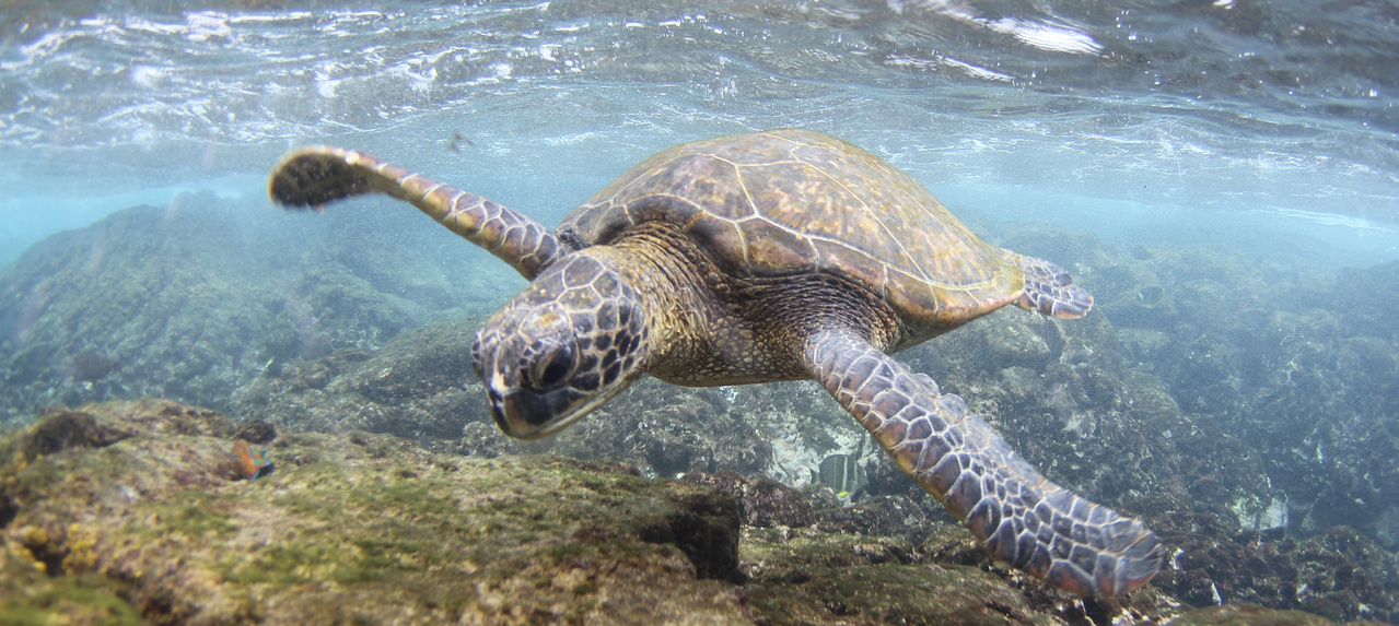
Green sea turtles got their periodic health checks at Punalu‘u on Friday from long time turtle researcher and conservationist George Balazs, NOAA, University of Hawai‘i Marine Options Program and Mālama Pono Punalu‘u, with federal permits granted. 
NOAA photo

GREEN SEA TURTLE EXPERT DR. GEORGE BALAZS CAME TO PUNALU‘U on Friday with University of Hawai‘i Marine Option students, researchers from NOAA and volunteers from Mālama Pono Punalu‘u. They began their mission to give honu- green sea turtles - a health check in a traditional Hawaiian ceremony with chanting and acknowledging the ocean and the honu as they faced the bay.
    With permits granted, they entered the waters with snorkeling gear, lifted turtles onto rafts and brought them to shore where they conducted health checks for disease, tumors, blindness. They measured and weighed each turtle and took them back into the bay.
    U.H. Hilo's Marine Option Program has assisted NOAA researchers for more than 40 years, with Balazs in the lead for most of those years. Green sea turtles were declared an endangered species and received federal protection in 1973. With NOAA, University of Hawai‘i, state Department of Land & Natural Resources and community organizations, their populations recovered from the time of possible extinction but remain endangered and protected from hunting and harassment. They often bask at Punalu‘u Beach and feed in the offshore waters. They are the largest hard-shelled turtles in the world and can weigh over 300 pounds.
    According to Rylee Clark and Ryan Sack who study the history of Turtle Tagging at Punalu‘u, it is one of the longest running studies of Hawaiian green sea turtles. They note that the Hawaiian population is a
Kauila, the hawksbill turtle goddess, is legendary at Punalu'u.
 Painting by Herb Kane
subpopulation of Chelonia mydas, genetically distinct from other green sea turtles. This biometric study has been crucial in determining the population's growth rate, habitat preference, and population trend, according to the researchers.
   One Marine Options project is a comprehensive history of involvement with this research. It compiles historical documents associated with turtle tagging at Punalu‘u Beach Park, and conducts interviews with key research participants.
    Another aims to analyze over 1,200 records of Punalu`u turtle data from 1976-present. It includes statistical analyses on carapace size, mass, presence of tumors, and differences between males and females, and comments made about the turtles when they were observed.
    Over the years, Balazs has also been involved the the rescue of two critically endangered female hawksbill turtles that were trapped in the Black Sand Beach pond. 
    In addition to its fame for basking green sea turtles, Punalu‘u is the place of the legend of the hawksbill turtle goddess Kauila, depicted in an image by famed artist Herb Kane whose paintings were displayed when a museum was located at Punalu‘u. Hawksbills nest at Punalu‘u almost annually.
    Balazs researches and seeks conservation of marine turtles worldwide, through his nonprofit. He served as Hawai‘i Senior Sea Turtle Scientist at NOAA’s Pacific Islands Fisheries Science Center. He says his mission is "Serving Sea Turtles and the Communities Culturally and Biopolitically Bonded to Them."

Volunteers, students and researchers participate in a ceremony of respect for ocean and honu ahead of giving green sea turtles their periodic health check at Punalu‘u Black Sand Beach on Friday. Photo by Ophir Danenberg

AN EVENT, CALLED KAʻŪ TIME TO SPEAK OUT and a Rally to Stop Big Development at Punalu‘u, has been set by Punalu‘u resident Guy Enriques for Saturday, March 2, from 10 a.m. to noon at Punalu‘u Big Pavillon at the County Park.
Guy Enriques during hawksbill turtle nesting season at
Punalu‘u Black Sand Beach. Photo by Jennifer Johansen
    According to a flyer for the event, the schedule and topics will be Update on Current Situation at 10 a.m., Speakers at 10:05 a.m., What's Next at 10:10 am. and Sign Waving at visible parts of Punalu‘u from 10:30 a.m. to noon.
    Enriques is leader of the Mālama Pono Punalu‘u organization that volunteers to help protect the honu and Punalu‘u Black Sand Beach. Enriques is a former County Councilman and is volleyball coach at Kamehameha School. He grew up at Punalu‘u where his mother, the late Jeanette Howard, started a lei stand in the 1950s. That business run by his extended family remains at Black Sand Beach today.
Enriques recently served as one the mentors for the Hawai‘i Tourism Authority's program to train stewards for Punalu‘u. HTA recently named Punalu‘u as one of two places needing stewardship to protect its resources and to educate visitors. Ten Ka‘ū residents received the training from Ka ‘Ohana O Honu‘apo who brought the trainees to Punalu‘u for a day to meet with Enriques during the four months of training.


TESTIMONY CAN BE GIVEN LOCALLY DURING THE PUNALU‘U SPECIAL MANAGEMENT AREA PERMIT PUBLIC HEARING next Thursday, March 7. County Council member Michelle Galimba announced on Friday that access to a Zoom link for public testimony to the Windward Planning Commission on the SMA permit application for a 225-unit development of accommodations plus commercial enterprise at Punualuʻu by Black Sands LLC will be available at Nāʻālehu Community Center on March 7, beginning at 9 a.m.
    She said, "This will allow those in the community who do not wish to travel to Hilo for the in-person meeting of the Windward Planning Commission at the County Council Chambers at the County Building and who do not wish to sign up for an individual Zoom link to still provide testimony on the SMA permit application."
    Staff from the office of Councilmember Galimba will be at Nāʻālehu Community Center to help community members to provide Zoom testimony to the Commission. The agenda for the Windward Planning Commission meeting is at https://records.hawaiicounty.gov/WebLink/1/edoc/128532/2024-03-07%20Planning%20Commission%20Agenda.pdf. 


The Hawai'i Tourism Authority's stewardship training for Punalu‘u is complete, according to HTA, which named Punalu‘u in
 need of management and the education of visitors. Photo by Julia Neal

A RECENT STEWARDSHIP TRAINING FOR PUNALU‘U has been completed and Hawai‘i Tourism Authority released a statement on Thursday. It says:
    "Ten Kaʻū community residents were recently celebrated at a hō‘ike in Pāhala for completing Ka‘ū Hoa Pili ‘Āina, a four-month, ‘āina-based education training program as part of the Hawai‘i Tourism Authority’s (HTA) destination management efforts and Hawai‘i Island Community-Based Action Stewardship Program."
“The Ka‘ū community voiced the need to better
 manage tourism impacts on the natural resources
 in Punalu‘u," said HTA Chair Mufi Hannemann
    “The Ka‘ū community voiced the need to better manage tourism impacts on the natural resources in Punalu‘u through place-based curriculum,” said Mufi Hannemann, HTA Board Chair who spent part of his career working in Pāhala and living in Nāʻālehu. "We thank Ka ‘Ohana O Honu‘apo for facilitating this community effort and the work of these local stewards to ensure the protection and preservation of this special place.”
    HTA reports that "Facilitated by the non-profit Ka ‘Ohana o Honu‘apo, a resource stewardship organization based in Nā‘ālehu, the Ka‘ū Hoa Pili ‘Āina program focused on recruiting and training ten local stewards in the practices of mālama ‘āina built on the foundation of cultural practices and protocols, conservation and biological sciences, and place-based messaging about the Ka‘ū area."
    Daniel Nāho‘opi‘i, HTA's interim president and CEO, said "It is important to HTA that we continue to listen to our residents and support the collaborative initiatives they want to see within their communities. Mahalo to these stewards for committing themselves to the rigors of the training and the stewardship of their home moku (district), Ka ‘Ohana O Honu‘apo for their leadership
“This pilot program is a partnership with the
 community to support place-based, kamaʻāina
 and visitor education efforts while mitigating
 user impacts in Punalu‘u and the greater Ka‘ū
 area,” said Destination Manager Rachel Kaiama.
and collaboration, and the many kumu and organizations for providing their mana‘o in this process.”
    The statement notes that "HTA is funding the Ka‘ū Hoa Pili ‘Āina program under its destination stewardship and community efforts as guided by its Hawai‘i Island Destination Management Action Plan (DMAP)."
    Rachel Kaiama, Island of Hawai‘i Visitors Bureau’s (IHVB) destination manager, said, “This pilot program is a partnership with the community to support place-based, kamaʻāina and visitor education efforts while mitigating user impacts in Punalu‘u and the greater Ka‘ū area.”
The HTA statement said, "As part of the training, Ka ‘Ohana o Honu‘apo worked with 13 other organizations to share information on a wealth of topics, including the Hawai‘i Wildlife Fund, Nā Mamo O Kāwā, Kua‘āina Ulu Auamo (KUA)’s Limu Hui, The Nature Conservancy, Hawai‘i Volcanoes National Park, Kalanihale, Hui Aloha Kīholo, Edith Kanaka‘ole Foundation, Kamehameha Schools, Volcano Rare Plant Facility, Kaulana Mahina, Island CPR and Mālama Pono Punalu‘u.
    "Trainees delved into land-use changes, watershed protection, heritage management and coastal restoration projects. They completed CPR and First Aid training and learned communication skills for sharing the importance of pono practices with visitors and kama‘āina.
"In addition to learning species identification and monitoring practices, the trainees took their skills out in the field to conduct ʻopihi monitoring and limu surveys. Other immersive activities included forest and loko i‘a (Hawaiian fish pond) restoration, marine debris removal, community-based management, communication skills building, mo‘olelo sharing and learning about impacts to watersheds.
 
  "Speaking on behalf of Ka ‘Ohana o Honu‘apo, a representative said the training was not intended to steward one place or one ʻāina, but instead, was a landscape-scale, comprehensive training program for the entire district of Ka‘ū.
    “'The trainees learned a great deal about the resources within Kaʻū, plus land-use changes over time, the impacts of climate change, invasive species, etc., and heard from experts in their fields relative to conservation and stewardship,' detailed the Ka ‘Ohana O Honu‘apo representative. 'They also formed collaborations and partnerships with other organizations and community members, which opened up the potential to learn and incorporate stewardship activities not yet happening in Kaʻū.'”
    "A potential stewardship opportunity cited was the success of community-based management in Miloliʻi, and how to bring those practices to the Kaʻū coastline. The trainees also studied the impacts of Rapid ʻŌhiʻa Death on Hawai‘i’s forests and ways to mitigate its spread through decontamination strategies and protocols.
    "Trainees received a monthly stipend for their participation and were required to attend all instructional events and steward-related opportunities, as well as engage with visitors to effectively communicate pono behaviors and safety protocols. In addition, they participated in a number of volunteer opportunities with multiple groups and organizations in Ka‘ū and South Kona. Trainees hailed from across the Kaʻū District.
    The HTA statement reports that "Sharing how the stewardship program has directed her 'to a purposeful life,' trainee Chelsae-Lynn Kobzi said the best part of the program was working with organizations and 'seeing whatʻs available out there as there is so much to do.' She added participation has 'brought me purpose, confidence and a whole new perspective.'
Ho‘ike for completion of the recent HTA stewardship training. Photo by Julia Neal
  "With a deeper connection to their ‘āina, the newly launched group of stewards can seek to reconnect with the different organizations and individuals they worked with during the training to remain involved in efforts to help mālama ‘āina. This can be done on a volunteer basis or through employment opportunities.
    "Looking to the future, Kaiama said the idea for the training program is to show how community stewardship training and implementation can be done and then hope for more like it to be self-sustained or partially supported by state and county agencies.
    “'It would be ideal for community-based steward programs to foster the economic job diversification we need as these volunteers and others like them can benefit from well-paying jobs that uplift their community while protecting the natural and cultural resources of the island,' added Kaiama. 'This is the regenerative tourism model we would like to see more of.'
    Funded and supported by HTA and administered by IHVB, the Hawai‘i Island Community-Based Action Stewardship Program "builds on the success of other community-based programs around the state including at Hanauma Bay State Park, Hā‘ena State Park and Lē‘ahi (Diamond Head State Monument)," says the HTA statement.
    To learn more about how destination management and stewardship is advancing on the island of Hawai‘i, visit: https://holomua.hawaiitourismauthority.org/hawaii-island/.


BLACK SAND BEACH, LLC PROVIDED IMAGES OF REPAIRS AND CLEANUP it has accomplished at Punalu‘u. Project Director Norman Quon said on Friday that the Black Sands team is all in with joining the community to clean up and plan for managing the traffic at the beach. He pointed to the restoration of parking away from the beach, the cleaning up of hazards at abandoned buildings, the blocking of parking along the road to the beach, repair of a walking bridge for pedestrians and overall increased landscape management. 
    The presentation of photos of the work includes a support statement for Black Sand Beach, LLC's proposal before the county's Windward Planning Commission for a Special Management Area permit. The project would include construction of 225 accommodations, rebuilding the old golf course clubhouse, restoring the golf course, building a wellness center, and putting a market and restaurant near the Black Sand Beach. It would also include planning for coastal preservation and public access.

The Planning Director's review points to an EIS and its Cultural Impact
 Assessment from 2006, as well as an updated Cultural Assessment
 by Black Sands, LLC. The old EIS can be read at 
https://files.hawaii.gov/dbedt/erp/EA_EIS_Library/2006-10-08-HA-DEIS-Sea-Mountain-Punaluu.pdf
COUNTY PLANNING DIRECTOR'S REPORT RECOMMENDING APPROVAL OF SPECIAL MANAGEMENT AREA PERMIT FOR BLACK SAND BEACH, LLC explains the purpose of the SMA regulations. This is the second installment of the report by County Planning Director Zendo Kern, issued ahead of the March 7 public hearing regarding approval of an SMA permit for the Black Sand Beach, LLC project:
    The purpose of Chapter 205A, Hawaii Revised Statutes ( HRS) and Special Management Area Rules and Regulations of the County of Hawai‘i, is to preserve, protect, and where possible, to restore the natural resources of the coastal zone areas.
    Therefore, special controls on development within an area along the shoreline are necessary to avoid the permanent loss of valuable resources and the foreclosure of management options. The objectives and policies of Chapter 205A, HRS include, but are not limited to, the protection of coastal recreational resources, historic resources, scenic and open space resources, coastal ecosystems, marine resources, beaches, and controlling development in coastal hazard areas.

     Coastal Recreational Resources: All proposed improvements will occur on State Land Use ( SLU) Urban designated lands, and no improvements are proposed within the entire shoreline frontage of the project site that is within the SLU Conservation District.
    Portion of the shoreline frontage of the project site managed by the County as part of the Black Sand Beach Park complex of which facility and ground maintenance is conducted by the County Parks and Recreation Department. There are numerous coastal recreational resources that are currently enjoyed by community members and visitors to the area. The beach park allows for camping, fishing, hiking, and includes pavilions for gathering and other recreational uses. The black sand beach is heavily used by visitors and the community for fishing, and beach- type activities. Access to the shoreline is via the county beach park, and the black sand beach area. Lateral shoreline access ( access along the shoreline) is open and accessible from many points along the shoreline of the project 
area. Staff visited the site and were able to traverse the entire shoreline from the most northern end of black sand beach south towards to the Beach Park and beyond. The proposed coastal reserve area will also provide additional cultural and recreational access and will preserve this area of the shoreline for the future. The proposed project will not 
interfere with the current level of shoreline access in this area, however, the increase in development will ultimately bring more visitors to the shoreline. In order to
Punalu'u Black Sand Beach. Photo by Ophir Danenberg
mitigate the increased foot traffic and visitors to the coastal area the applicant will work to improve the existing infrastructure to accommodate the increase in visitors, as well as providing consistent resource management which has been severely lacking over the past 2 decades.
    The applicant has already begun improving the parking area that provides access to the Black Sand Beach area, minimizing the current parking scheme which allows vehicles to park next to the pond and on the sandy beach. Based on the proposed development being outside the shoreline area, as well as the dedication of the coastal preservation site, and the improvements to existing infrastructure ( i. e., parking), the Planning Department believes the impacts to coastal resources can be mitigated. Additionally, having one entity ( landowner) that has the ability to holistically manage the entire project site where no management has been occurring is an improvement. The applicant will also be required to address, via study, the proposed projects potential impacts on coastal, cultural, and water quality via the submission of a Water Quality and Marine Life Monitoring and Management plan, Pond management plan, Cultural Resources Management plan, and a Shoreline Management Plan all to be approved by the Planning Dept. prior to development to further enshrine the conservation of the areas resources. Based on our review, the proposed projects potential impacts to the coastline or other areas utilized for public recreational activities at the shoreline will be mitigated, and therefore will not impede or hinder the public's ability to access the shoreline.
    Historic and Cultural Resources: The extensive project area includes cultural remains, such as a heiau, burial sites and habitation sites, and natural resources such as ponds, black sand beach, viewplanes, and the rugged Ka‘ū coastline — all of which are considered significant cultural and historic resources. While there are numerous sites throughout the area, the project has been designed to not impact lands where known cultural sites or features have been identified by the cultural and archeological assessments conducted for this application. 
    Staff notes that based on information provided, the majority of the new development will occur in areas previously disturbed by past land use activities including extensive grading which occurred in this area in the 1960s- 1970' s (prior to SMA law). The 2006 Cultural Impact Assessment (CIA) and the subsequent updated CIA in 2023 identified important cultural site and practices within the project site, which include: stone cultural remains (e.g., heiau, ahu, caves, mounds, enclosures), petroglyphs and trail segments, a fishpond, marine resources important to native Hawaiians, and the black sand beach. Additionally, since 1969 the project area has been extensively developed, which included significant grading and grubbing of the landscape to create the golf course. 
    Several cultural resources were identified in archival literature, archaeological surveys, and interviews conducted for ethnographic study and included in the updated CIA. The sites identified include heiau and ko‘a shrines, burial sites, a historic cemetery associated with a historic church, petroglyph areas, and other storied places. Other cultural resources for this community include the gathering of plants such as coconut, kukui, noni, ti pants, hau, hala, various medicinal plants, lei flowers, and seeds that are found throughout the project area. 
Planning Director Zendo Kern writes that one of the most significant cultural resources of Punalu‘u is the ocean, bays, coves and rugged Kaʻū Coast and that Punalu‘u is the only viable, accessible beach for residents from Pāhala to Nāʻālehu. 
Photo by Ophir Danenberg
    One of the most significant cultural resources of the Punalu' u area is the ocean, bays, coves, and coastal areas within the project area as well as beyond the project site boundaries. From the Volcano area to South Point, Punalu`u is the only viable/ accessible beach for the residents from Pahala to Na`alehu and as such maintaining continued access to the beach, ocean, and coastal area is important to this region.
    As stated in the 2006 CIA, the entire Punalu`u area (Punalu`u, Ninole, Hama, Wailau and Hilea) still has an abundance of cultural resources in spite of prior plantation and resort activities simply because the people of this area continue to practice these cultural traditions. Despite the vegetation overgrowth and dilapidated former resort structures, the area continues to be utilized by locals and visitors alike. 
    The proposed development will likely impact some cultural resources during and after construction, such as sub-surface structures, midden, artifacts, or unmarked reburials. This could be mitigated with a cultural monitor and archaeologist present for any subsurface activity as well as surface activity. Preservation and Burial Treatment plans are recommended to properly care for identified archaeological features recommended for preservation. In addition, the CIA Update recommended that mitigation should include a walk-through of kupuna/cultural practitioners, Kuleana landowners, the archaeologist, and the development planners to record all the burial areas that are not recorded in the archaeology report or SMA application. 
    An advisory group made up of primarily kupuna knowledgeable of the area, Kuleana owners and other Punalu`u landowners, could be formed to advise planners of cultural protocol, sensitive areas, and cultural resources burials, medicine, food and craft plants, and other cultural resources). Before any future construction is started an additional Burial Treatment Plan for inadvertent burials or reburials is recommended that includes cultural protocols (i.e. re-wrapping ` iwi kupuna, ceremony, etc.) as well as State and County regulations. Any construction ground activity will include the requirement to have a cultural and archeological monitor on- site during all ground disturbing activities.


APPLYING FOR HEAD AND ASSISTANCE FOOTBALL COACHING POSITIONS through Kaʻū High School Athletic Department has been extended through Thursday, March 28 at noon. Applications can be picked up at the Kaʻū High & Pāhala Elementary School office. Completed applications can be dropped off to the school office or to the Athletic Director's office. For more information or questions, call Athletic Director Jaime Guerpo at (808)313-4161 or (808)289-3472.