 |
| A magnitude-5.2 earthquake, indicated by the large red circle, occurred in Hawai`i Volcanoes National Park last night. Map from USGS/HVO |
A MAGNITUDE-5.2 EARTHQUAKE ROCKED Hawai`i Island at 10:10 p.m. yesterday. The Pacific Tsunami Warning Center determined that the earthquake generated no damaging tsunami.
According to Wes Thelen, USGS Hawaiian Volcano Observatory’s Seismic Network Manager, the earthquake was centered about 11.4 kilometers (7.1 miles) south-southeast of the summit of Kilauea and at a depth of approximately 8.5 km (5.3 mi). A map showing its location is posted on the HVO website at http://hvo.wr.usgs.gov/seismic/volcweb/earthquakes/. |
| Wes Thelen |
The USGS "Did you feel it?" website (http://earthquake.usgs.gov/eqcenter/dyfi/) received more than 740 felt reports within an hour of the earthquake. It was felt across Hawai`i Island as well as on parts of Maui, Lana`i and O`ahu. Reports indicate that residents experienced light shaking (Intensity IV) during the earthquake. At these shaking intensities, damage to buildings or structures is not expected, though items not properly secured could have fallen over.
Five aftershocks were recorded within the first hour of the earthquake, including a magnitude-3.1 earthquake at 10:54 p.m. More aftershocks can be expected, including some that might be felt, Thelen said.
Eight earthquakes with magnitudes of four or greater, including three with magnitudes of five or greater, have occurred in this same area, the central part of Kilauea’s south flank, and at nearly the same depth (eight to 10 km or five to six mi), in the last 20 years. These quakes are thought to be caused by southward movement of the volcano’s south flank in response to magmatic pressure within Kilauea’s East Rift Zone.
HVO Scientist-in-Charge Tina Neal said the earthquakes had no apparent effect on Kilauea’s ongoing eruptions. “HVO monitoring networks have not detected any significant changes in activity at the summits or rift zones of Kilauea or other Hawaiian volcanoes,” she said.
For more information on recent earthquakes in Hawai`i and eruption updates, see hvo.wr.usgs.gov.
To comment on or like this story, go to facebook.com/kaucalendar.
MAP AND NEWSPAPER ARCHIVES HELP USGS Hawaiian Volcano Observatory scientists unravel the eruptive histories of Hawaiian volcanoes. HVO scientists extract as much insight as possible from historic accounts of eruptions and then combine that information with current observations of activity to improve their understanding of how Hawaiian volcanoes work. Recent Volcano Watch articles have compared past records for topics such as the Halema`uma`u lava lakes over time, the Mauna Loa lava flow that threatened Hilo in 1881, and the Kilauea lava flow that threatened Pahoa in 2014–2015.
In the current issue, HVO scientists discuss research on the Mauna Loa eruption that started on Nov. 5, 1880. The detective work “reveals that witnesses saw three separate lava flows advance from the volcano’s Northeast Rift Zone in the first few days of the eruption,” the article states. “The first flow (the Mauna Kea branch) advanced north into the Saddle area and stalled a few days later. The second flow (the Ka`u branch) moved toward Kilauea caldera and also stalled several days later. The third and last lava flow from this eruption (the Hilo branch) advanced toward the northeast and, by summer of 1881, threatened Hilo (this flow was the subject of our March 26, 2015, Volcano Watch).
COWBOY CHURCH IS A WEEK from today at 10 a.m. with Thy Word Ministries-Ka`u Pastor Bob Tominaga. Next Sunday is the second day of Ka`u Roping and Riding Association’s 38th annual Fourth of July Rodeo. Shows start at 12 p.m. both days. On Saturday, slack roping begins at 8 a.m.
SUPPORT OUR SPONSORS AT PAHALAPLANTATIONCOTTAGES.COM AND KAUCOFFEEMILL.COM. KA`U COFFEE MILL IS OPEN SEVEN DAYS A WEEK.


Five aftershocks were recorded within the first hour of the earthquake, including a magnitude-3.1 earthquake at 10:54 p.m. More aftershocks can be expected, including some that might be felt, Thelen said.
Eight earthquakes with magnitudes of four or greater, including three with magnitudes of five or greater, have occurred in this same area, the central part of Kilauea’s south flank, and at nearly the same depth (eight to 10 km or five to six mi), in the last 20 years. These quakes are thought to be caused by southward movement of the volcano’s south flank in response to magmatic pressure within Kilauea’s East Rift Zone.
HVO Scientist-in-Charge Tina Neal said the earthquakes had no apparent effect on Kilauea’s ongoing eruptions. “HVO monitoring networks have not detected any significant changes in activity at the summits or rift zones of Kilauea or other Hawaiian volcanoes,” she said.
For more information on recent earthquakes in Hawai`i and eruption updates, see hvo.wr.usgs.gov.
To comment on or like this story, go to facebook.com/kaucalendar.
KA`U FARMERS, RANCHERS, land managers and other interested persons took a class in conflict management yesterday, sponsored by the Kohala Center and led by mediation trainer Teresa Young. The class, held at Ka`u Coffee Mill, focused on mediation skills likely needed for Ka`u Agricultural Water District Cooperative’s mission to manage agricultural water under license from the state. The state owns all water resources and much of the land where old plantation water tunnels and springs are located in Ka`u.
Before the workshop, state Department of Agriculture chief Scott Enright said the license could be issued sometime this year. He talked about the need for various entities overseen by the co-op, completing their organizing around ag water sources. The group has worked on the project to restore the old sugar plantation system for current ranching and farming for about a decade. Funding is coming from the state and private resources.
 |
| State Ag Department Chief Scott Enright spoke in Ka`u yesterday. |
When asked about more funding for ag water, Enright said that funding already approved will need to show growth in agriculture here and that farmers and ranchers can approach state legislators to consider more money.
Enright also mentioned that Jeff Melrose, who has identified and mapped the agricultural operations on the Big Island and elsewhere in Hawai`i, is also mapping water resources, which will be available to the public online.
Suggestions during the workshop included studying and anticipating all needs of possible stakeholders who could want water in the future; understanding how each of the Ka`u ag water systems would work and who pays for distribution lines; understanding that those who provide distribution can charge for water; and limitations of the sources during rainy and drought times. Planning of equitable distribution of water during droughts was also discussed. The need for a fire plan, concerning use of ag water during forest and range fires, also came up.
Interests that could become involved with the Ka` u water system that were mentioned included Office of Hawaiian Affairs, which asks the state for a percentage of income from water sold. Enright said that the state does not plan to charge farmers and ranchers for the water though there is a possibility of a watershed protection fee. Also mentioned was an Earth Justice lawsuit concerning equitable distribution of water in another abandoned former sugar plantation at Kekaha on Kaua`i. Another interested party is Department of Hawaiian Home Lands, which sent a representative to the meeting and has plans to bring water to Hawaiian ranchers at Ka Lae and possibly other ag lots owned by DHHL in Ka`u.
Concerning the cooperative’s efforts, Eright said, “We live in a water-scarce world, and this is important work.”
See a workbook on conflict resolution and planning to prevent conflict at www.kohalacenter.org/laulima/kauwater.html.
To comment on or like this story, go to facebook.com/kaucalendar.
MAP AND NEWSPAPER ARCHIVES HELP USGS Hawaiian Volcano Observatory scientists unravel the eruptive histories of Hawaiian volcanoes. HVO scientists extract as much insight as possible from historic accounts of eruptions and then combine that information with current observations of activity to improve their understanding of how Hawaiian volcanoes work. Recent Volcano Watch articles have compared past records for topics such as the Halema`uma`u lava lakes over time, the Mauna Loa lava flow that threatened Hilo in 1881, and the Kilauea lava flow that threatened Pahoa in 2014–2015.
In the current issue, HVO scientists discuss research on the Mauna Loa eruption that started on Nov. 5, 1880. The detective work “reveals that witnesses saw three separate lava flows advance from the volcano’s Northeast Rift Zone in the first few days of the eruption,” the article states. “The first flow (the Mauna Kea branch) advanced north into the Saddle area and stalled a few days later. The second flow (the Ka`u branch) moved toward Kilauea caldera and also stalled several days later. The third and last lava flow from this eruption (the Hilo branch) advanced toward the northeast and, by summer of 1881, threatened Hilo (this flow was the subject of our March 26, 2015, Volcano Watch).
 |
| Archival map shows lava flows in the saddle between Mauna Loa and Mauna Kea (at top). Hawai`i State Archives map from HVO |
“Until recently, all three branches of the 1880–1881 lava flows were represented on geologic maps of the Island of Hawai`i. But an ongoing remapping effort for Mauna Loa has produced some surprises — one of which is that the flow mapped as the first and northernmost 1880 lava (the Mauna Kea branch) was actually erupted a few years later — in 1899.
“The true identity of this flow was determined by matching its chemistry with other lavas that are known with certainty to have been erupted in 1899. It would be hard to challenge such definitive geochemical evidence, but we still don’t know what happened to the reported Mauna Kea branch of the 1880–1881 eruption.
“Going back to newspapers of the time, one can find clear descriptions of the three flow branches, with the first branch advancing north into the saddle just north of the Mauna Loa 1855 lava flow (right where it was formerly mapped). One of these accounts described a trip by a pair of explorers who traveled from the vent high on the rift zone down into the Saddle along the Mauna Kea branch of the flow.
“Of course, GPS didn’t exist in the 1880s, so these travelers, at best, might have had a barometer that estimated elevation using variations in air pressure. Some travelers recorded approximate elevations of landmarks that we can recognize today. A few others published sketch maps in the newspaper along with their harrowing accounts of the eruption.
“In addition, government surveyors of that era were working hard on mapping the Hawaiian Kingdom using triangulation and chaining distances (literally using a chain of known length and counting how many ‘chains’ it took to replicate the distance). Toward the end of the nineteenth century, many areas were mapped, including the Saddle between Mauna Kea and Mauna Loa. There was a lot of sketching ‘by eye’ that went into mapping the Mauna Loa side of the Saddle, but it was still useful.
“Some of these wonderful old maps can be found online at the Hawai`i State Archives (http://ags.hawaii.gov/survey/map-search/). For this particular quest, registered map number 1718 (from the year1891) shows the first branch of the 1880–1881 lava flows (a dark, thumb-shaped lobe peeking up from the bottom of the map) lying on 1855–1856 lava.
“These maps confirm that there was a Mauna Kea branch of the 1880–1881 eruption, but that, in fact, it may have only been about 13 km (eight mi) long instead of 20 km (12 mi) long, as the map showed it until recently.
“With further mapping, the Mauna Kea branch may have been found again — under the later 1899 flows or to the side of the 1855–1856 flow. The challenge now is to see whether we can identify the Mauna Kea branch in remaining kipuka within the 1899 flow or nearby areas.
“Boots-on-the-ground field work is still the best way to ascertain the geologic record of a volcano. However, geologic questions can sometimes be answered by good old archival research, so we are fortunate that so many archives are now available online.”
See hvo.wr.usgs.gov/volcanowatch.
To comment on or like this story, go to facebook.com/kaucalendar.
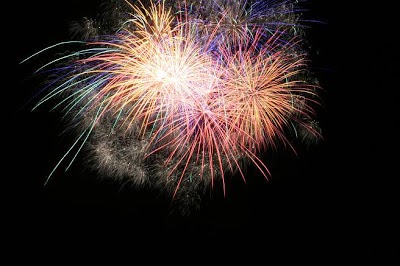 |
| Fourth of July fireworks sales begin today. |
FIREWORKS SALES BEGIN TODAY and end at 8 p.m. on Saturday, July 4. There are no retail locations selling firecrackers that require a permit to purchase. However, permits will be required to set off firecrackers purchased previously. Permits are not required for other consumer fireworks and paperless firecrackers.
Call the Fire Department Prevention Bureau at 932-2915 or 932-2912 regarding purchase of permits.
COWBOY CHURCH IS A WEEK from today at 10 a.m. with Thy Word Ministries-Ka`u Pastor Bob Tominaga. Next Sunday is the second day of Ka`u Roping and Riding Association’s 38th annual Fourth of July Rodeo. Shows start at 12 p.m. both days. On Saturday, slack roping begins at 8 a.m.
SUPPORT OUR SPONSORS AT PAHALAPLANTATIONCOTTAGES.COM AND KAUCOFFEEMILL.COM. KA`U COFFEE MILL IS OPEN SEVEN DAYS A WEEK.


 |
| See kaucalendar.com/Directory2015.pdf and kaucalendar.com/Directory2015.swf. |

