 |
| Kahuku-Pōhue parcel skirts Pōhue Bay and the Kaʻū Coast, attached to 16,451 acres, recently acquired by Hawaiʻi Volcanoes National Park and subject of a public input meeting Aug. 13. NPS Photo |
THE MEETING ON THE PŌHUE BAY LANDS just acquired by Hawaiʻi Volcanoes National Park is subject of a call for public participation on Saturday, Aug. 13, from 1 p.m. to 3 p.m. at Ocean View Community Center, 92-8924 Leilani circle. National Park Service has sent out an invite to the public regarding the session on "protection and potential future use of the remote 16,451-acre Kahuku-Pōhue parcel the park acquired last month."
Park managers are "seeking feedback from the community about the natural and cultural resources of the area, and wish to explore suggestions for public use that are compatible with resource protection," says the invite.
 |
| Brackish water pond that connects to the ocean at high tide. NPS Photo by Jessica Ferracane |
The Park statement says that before the land transfer, the park met with community members in partnership with Trust for Public Land and Hawaiʻi Alliance for Community-Based Economic Development "to better understand the land's cultural, historical and ecological significance. Community engagement will continue over the next few months. Until Pōhue interim operating procedures can be worked out, and safe access protective of cultural and natural resources can be ensured, public access to the Kahuku-Pōhue parcel is temporarily restricted.
"There are no restroom facilities or capacity for trash removal, and emergency response is very limited. Portions of the current jeep trail and pedestrian routes to the coastline pass through private lands not managed by the park."
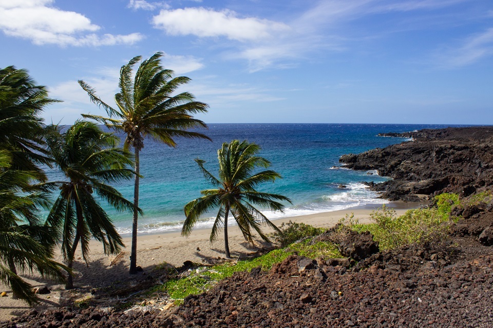 |
| Pōhue is one of the few white sand beaches found on the southern part of the island of Hawaiʻi. NPS Photo by Jessica Ferracane |
The Park website includes a section on Kahuku-Pōhu'e at www.nps.gov/havo/learn/historyculture/kahuku-pohue.htm It includes the following:
"Located on the southern flank of Mauna Loa, the
Kahuku-Pōhue parcel is home to numerous well-preserved and significant
Hawaiian cultural sites, including the largest recorded abrader quarry
in Hawaiʻi, lava tubes, burial site, mauka-makai (mountain to sea)
trails, fishing shrines, remains of once-thriving coastal villages, and petroglyphs.
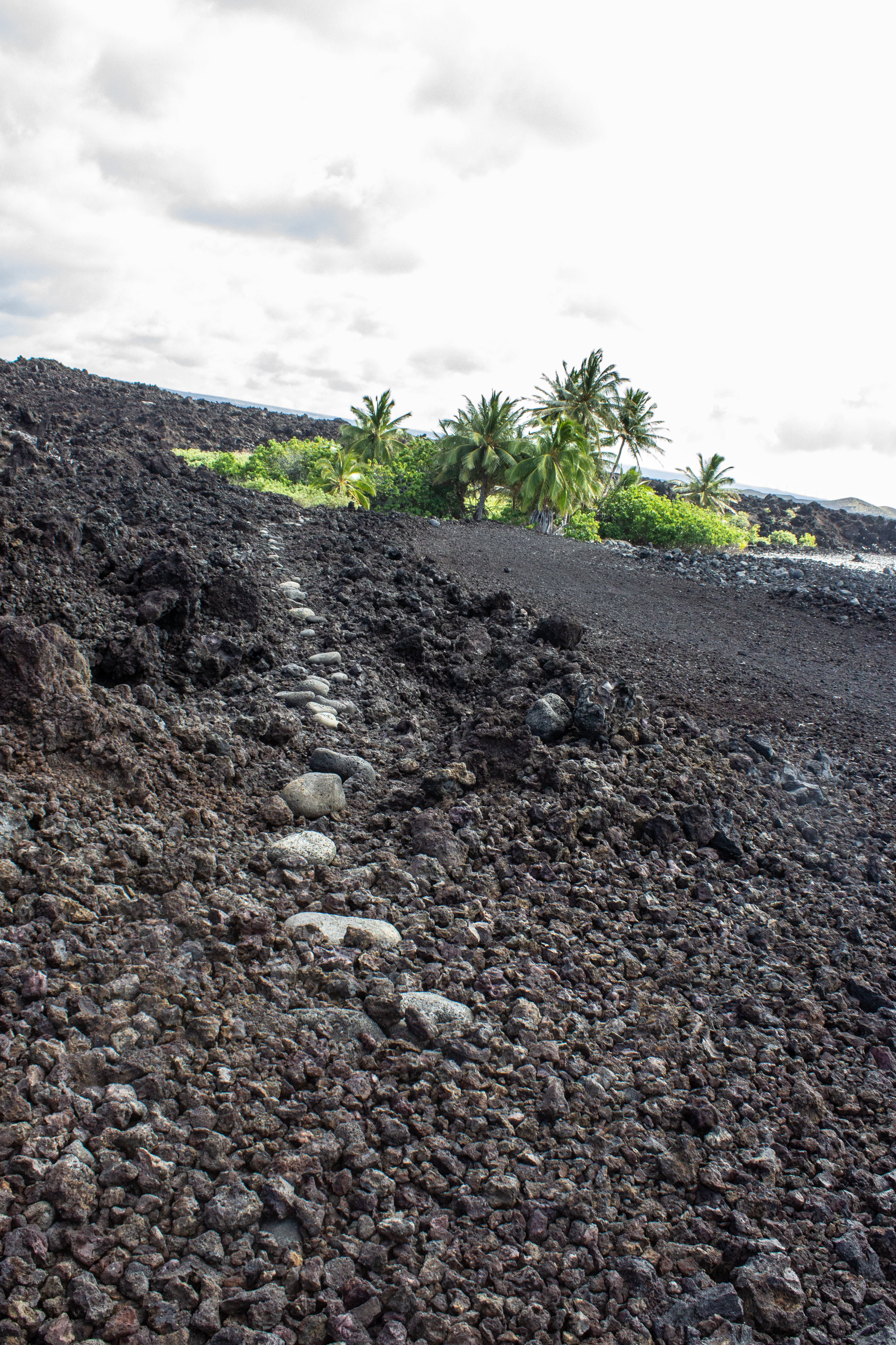 |
| Pōhue holds a network of culturally and historically significant trails. NPS Photo by Jessica Ferracane |
A well-preserved portion of the Ala Kahakai National Historic Trail or Ala Loa, an ancient coastal trail system, hugs the coastline. The Pōhue coastline is also critical habitat for federally listed endangered Hawaiian species, including honu‘ea (Hawaiian hawksbill turtle) and ʻīlioholoikauaua (Hawaiian monk seal). Rare endemic ʻōpaeʻula (red shrimp) live in the area’s anchialine ponds, and the bay is often frequented by native and migratory birds, including ʻiwa (frigate bird), koaʻe kea (white tailed tropic bird), kōlea (golden plover), ʻūlili (wandering tattler) and ʻaukuʻu (black crowned night heron).
The statement notes that "On July 12, 2022, the Trust for Public Land transferred ownership and stewardship of Kahuku-Pōhue to the National Park Service. The 16,451-acre parcel—from Māmalahoa Highway to the shoreline—is now part of Hawaiʻi Volcanoes National Park. Trust for Public Land has also donated $800,000 to the Friends of Volcanoes National Park to support the National Park Service’s management of Pōhue Bay."
Park Superintendent Rhonda Loh said, “Pōhue is an incredibly precious and culturally significant landscape that needs to be protected.... the park is working to develop an interim operating plan for Pōhue that explores opportunities for public use compatible with resource protection. We thank the community for your patience and for the manaʻo shared so far."
WAIEA IS NOW A STATE NATURAL AREA RESERVE, north of Miloliʻi and inland
from Hoʻokena Beach Road. State Department of Land & Natural
Resources released a statement this week saying, "A roughly 1,260-acre
parcel in Waiea, on Hawai‘i island has been designated as part of the State Natural Area Reserve System managed by the DLNR Division of Forestry and Wildlife."
Waiea NAR contains moist koa and ‘ōhi‘a dominated forests on the western flank of Mauna Loa within the South Kona district. "It is great habitat for rare forest birds and plants. In fact, wild ʻalalā (Hawaiian crow) were last observed in Waiea," says the DLNR statement.
The new reserve is approximately 1.5 miles mauka (upland) of where Highway 11 (Mamalahoa Hwy) intersects with Ho‘okena Beach Road. While NARs are generally open to everyone for hiking and nature study, this area is currently landlocked by adjacent private land, so currently there is no access.
DLNR says Waiea is unique, "because it has distinct seasonality compared to other forests in the NARs system. It evolved under a summer wet season, while most wet forests in Hawaiʻi evolved with a winter wet season."
The NAR system "seeks to keep these forests as intact as possible, to preserve plants and wildlife that evolved over millennia to become unique to the islands. Protection of these species perpetuates the cultural practices that evolved with these ancient landscapes.
"These native Hawaiian forests absorb rain, providing life-giving water, while reducing erosion onto beaches and reefs below. NARs have the highest levels of protection in the state to ensure that current and future generations can continue to experience these incredible places that make Hawaiʻi so unique."
Individuals interested in learning more and giving back to the NAR system can take an online tour and make donations which will support planting native trees or removing invasive species like rats or feral goats, that can wipe out the last known individuals of extremely rare species. "This support is critical for local conservation work," says the DLNR statement.
To read comments, add your own, and like this story, see www.facebook.com/kaucalendar. See latest print edition at wwwkaucalendar.com. See upcoming events at https://kaunewsbriefs.blogspot.com/2022/04/upcoming-events-for-kau-and-volcano.htm
The statement notes that "On July 12, 2022, the Trust for Public Land transferred ownership and stewardship of Kahuku-Pōhue to the National Park Service. The 16,451-acre parcel—from Māmalahoa Highway to the shoreline—is now part of Hawaiʻi Volcanoes National Park. Trust for Public Land has also donated $800,000 to the Friends of Volcanoes National Park to support the National Park Service’s management of Pōhue Bay."
Park Superintendent Rhonda Loh said, “Pōhue is an incredibly precious and culturally significant landscape that needs to be protected.... the park is working to develop an interim operating plan for Pōhue that explores opportunities for public use compatible with resource protection. We thank the community for your patience and for the manaʻo shared so far."
.jpg) |
| Puʻu Kī, the large cinder cone along the coastline of Pōhue. NPS Photo by Jessica Ferracane |
To read comments, add your own, and like this story, see www.facebook.com/kaucalendar. See latest print edition at wwwkaucalendar.com. See upcoming events at https://kaunewsbriefs.blogspot.com/2022/04/upcoming-events-for-kau-and-volcano.htm
 |
| Aiea. Photo from DLNR |
Waiea NAR contains moist koa and ‘ōhi‘a dominated forests on the western flank of Mauna Loa within the South Kona district. "It is great habitat for rare forest birds and plants. In fact, wild ʻalalā (Hawaiian crow) were last observed in Waiea," says the DLNR statement.
The new reserve is approximately 1.5 miles mauka (upland) of where Highway 11 (Mamalahoa Hwy) intersects with Ho‘okena Beach Road. While NARs are generally open to everyone for hiking and nature study, this area is currently landlocked by adjacent private land, so currently there is no access.
 |
| Waiea understory. Photo from DLNR |
The NAR system "seeks to keep these forests as intact as possible, to preserve plants and wildlife that evolved over millennia to become unique to the islands. Protection of these species perpetuates the cultural practices that evolved with these ancient landscapes.
"These native Hawaiian forests absorb rain, providing life-giving water, while reducing erosion onto beaches and reefs below. NARs have the highest levels of protection in the state to ensure that current and future generations can continue to experience these incredible places that make Hawaiʻi so unique."
Individuals interested in learning more and giving back to the NAR system can take an online tour and make donations which will support planting native trees or removing invasive species like rats or feral goats, that can wipe out the last known individuals of extremely rare species. "This support is critical for local conservation work," says the DLNR statement.
 |
| Waiea fenceline. Photo from DLNR |
To read comments, add your own, and like this story, see www.facebook.com/kaucalendar. See latest print edition at wwwkaucalendar.com. See upcoming events at https://kaunewsbriefs.blogspot.com/2022/04/upcoming-events-for-kau-and-volcano.htm


.jpg)