 |
| Hawai'i's First Lady Jaime Kanani Green and Gov. Josh Green, following his inauguration to become Hawai'i's ninth governor on Monday. Photo from the Governor's Office |
 |
| Dr. Josh Green started as a physician in Kaʻū and ran for state office in Kona. This photo is from 2012 when he was a state Senator. Now he is Governor. |
During his swearing in ceremony in Honolulu, Green called for unification with Hawai‘i as "one ‘ohana – one family." The first press release issued from the new Governor's pressroom says, "With his work as a doctor on the Big Island and the years that followed as a member of the House of Representatives, the Senate, and as Lt. Governor, Green has seen the difficulties faced by local families.As Lt. Governor, Green began to address the homeless crisis inspired by the work at Kahauiki village, identifying land in Waimānalo and Kalaeloa to place a few tiny homes and create kauhale, or villages. This work will continue under his leadership as Governor, including plans to immediately authorize the release of the $50 million of grants-in-aid before the new year and outreach that has already begun with each of Hawai‘i’s mayors to build kauhale communities in every county."
In his inaugural address, Green outlined plans to "unite the state towards a common purpose," His statement describes them as:
"Empowering the Department of Hawaiian Homelands to deliver on the state’s commitment to Native Hawaiians by housing the thousands of Hawaiian families on the waiting list;
"Addressing the healthcare disparities that affect the citizens of Hawai‘i;
"Using scholarships to pay down loans that healthcare professionals like social workers, nurses, and doctors have accrued so they can afford to provide care for those in Hawai‘i who need it the most;
"Eliminating regressive taxes, like the tax on food and medicine, which often disproportionately impacts those struggling to survive from paycheck to paycheck. Finding a path to restore justice to those who have lost their way and have been forgotten by the legal system, but do not deserve to be lost forever.
"Addressing the effects of climate change on Hawai‘i and the planet, and reaching the state’s ambitious renewable energy goals.
The new governor proclaimed, “When we come together, we can meet any challenge, and accomplish anything we set our minds to. We can set an example for the whole world on the issues of housing, homelessness, poverty, and climate change if we truly come together and commit to putting our values of
‘ohana and aloha into practice – and make them a reality for everyone in Hawai‘i.”
Green was sworn in before approximately 1,000 people at the Neal S. Blaisdell Arena. Sylvia Luke was sworn in as Lt. Governor, becoming the first person of Korean ancestry elected to statewide office.
Joining First Lady Jaime Kanani Green and the first family, were former Governors and First Ladies, Gov. George Ariyoshi and Jean Ariyoshi, Gov. John Waihe‘e and Lynne Waihe‘e, Gov. Linda Lingle, Gov. Neil Abercrombie and Dr. Nancie Caraway, and Gov. David Ige and Dawn Ige. Ali‘i trusts and royal societies were also present, including representatives from The Queen’s Health Systems, King William Charles Lunalilo Trust, The Kamehameha Schools, ‘Ahahui Ka‘ahumanu, Hale O Nā Ali ‘i, Māmakakaua, Daughters of Hawai‘i, and the Association of Hawaiian Civic Clubs.
Click here to see Gov. Josh Green’s Inauguration speech. Click here to see the Governor's entire
HAWAI'I COUNTY'S NEXT POLICE CHIEF CANDIDATES ARE NARROWED TO FOUR. Hawaiʻi County Police Commission made the announcement Tuesday, after meeting on Nov. 18. Between then and now, one has withdrawn. The remaining four candidates are in alphabetical order: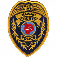 · Paul N. Applegate, Acting Assistant Chief, Patrol Services Bureau at the Kauaʻi Police Department.
· Sherry D. Bird, Police Major, Area II Field Operations Bureau, at the Hawaiʻi Police Department.
· Edward G. Ignacio, retired Senior Resident Agent for the Federal Bureau of Investigations, former Police Officer at the Hawaiʻi Police Department and Honolulu Police Department.
· Benjamin T. Moszkowicz, Police Major, Traffic Division, at the Honolulu Police Department.
The Commission will interview the finalists, and the community can provide input at two upcoming meetings. Both meetings will start at 9 a.m. The first meeting will be held in Hilo, on Monday, Dec. 12, at the Hawaiʻi County Building, Council Chambers, Suite #1401, 25 Aupuni Street, Hilo. The second will be held in Kona on Tuesday, Dec. 13 at the West Hawaiʻi Civic Center, Council Chambers, Building A, 74-5044 Ane Keohokalole Highway, Kailua-Kona.
THE FIRST CONFIRMED NEST OF THE ENDANGERED NOCTURNAL SEABIRD, the 'ākeʻāke, located in Hawai'i Volcanoes National Park, has been revealed. Video shows the fluffy fledgling Hawaiian petrel emerging from its high-elevation burrow on Mauna Loa about a month before the eruption began, "an exciting first for Hawaiʻi Volcanoes National Park," reports HVNP.
"The ʻākeʻāke burrow was detected in the park by a really good boy named Slater of Hawaiʻi Detector Dogs, under the guidance of trainer and handler Dr. Michelle Reynolds," says the Park statement. Biologist Charlotte Forbes Perry observed the chick inside its burrow after Slater sniffed it out in September – weeks before it emerged.
"Biologists in the park have known of the presence of ʻākeʻāke on Mauna Loa since the 1990s. In 2019, ʻākeʻāke burrow calls were recorded during acoustic monitoring which indicated nesting. The lack of visual signs, like guano at their nest sites, make them extremely hard for humans to locate," Forbes Perry said. "We worked with Hawai'i Detector Dogs, and in two days, Slater located an ʻākeʻāke nest and three Hawaiian petrel nests," she said.
Forbes Perry, a biologist with the University of Hawaiʻi Pacific Cooperative Studies Unit, and her team study seabirds in Hawaiʻi Volcanoes National Park under a permit from the U.S. Fish & Wildlife Service, an active partner on the project. After Slater discovered the nests, wildlife cameras were installed to monitor the burrows.
'Ākeʻāke, also known as the band-rumped storm petrel (Oceanodroma castro), are small (adults weigh about as much as a golf ball) and are ash black with a wide white band on their squarish tail, according to the American Bird Conservancy. They nest on isolated islands but spend the rest of their lives at sea. The global population is estimated to be about 150,000 individuals, with about 240 pairs known in Hawaiʻi.
Threats in Hawaiʻi include predation by non-native barn owls, cats and mongoose, and disorientation from artificial lights. Like ʻuaʻu (Hawaiian petrels), and other seabirds, ʻākeʻāke fly to their breeding sites
in darkness.
Slater and trainer/handler Reynolds were also part of the team that discovered a new ʻākeʻāke burrow at the U.S. Army Garrison Pōhakuloa Training Area in early September. The nests at PTA and Hawaiʻi Volcanoes National Park are the only documented ʻākeʻāke nests in Hawaiʻi.
The ʻākeʻāke and ʻuaʻu burrows are protected within the park's 644-acre cat-proof fence and are not threatened by the current eruption of Mauna Loa volcano. People can help ensure the safety of seabirds by controlling their pets, especially cats, and using dark-sky friendly lighting. Bright urban lights disorient seabirds like ʻākeʻāke and ʻuaʻu.
The Park statement says, "While many are transfixed by the eruption that began on Nov. 27, Forbes Perry and other conservationists are equally excited by the discovery of the ʻākeāke nest. "We are ecstatic by these finds, and detector dogs are an invaluable resource to help locate these elusive birds," she said.
DURING MAUNA LOA'S ERUPTION, HAWAI'I ARMY NATIONAL GUARD is partnering with County of Hawaiʻi to keep motorists and pedestrians safe in and around the Traffic Hazard Mitigation Route where people watch the lava flow. National Guard troops arrived Tuesday for a briefing with County officials related to their new post along the old Saddle Road. Approximately ten guardsmen will be posted for 12-hour shifts. A total of 20 guards have been sent to help respond to the increased traffic related to the eruption. "Their presence is expected as long as the need is there," said a statement from Hawai'i County.
"Guardsmen are here to help with the increased traffic along our Traffic Hazard Mitigation Route," said
Maurice Messina, Director of Parks and Recreation. "They're here to be aloha ambassadors, ensuring that motorists remain on the appropriate roadway and out of restricted areas, especially as visibility lessens with the weather."
"We're excited to have the Guardsmen here with us through our current response to the eruption," said Mayor Mitch Roth. "As more and more vehicles make their way through the mitigation route, it's imperative that we prioritize the safety of every person and vehicle on the roadway, which requires manpower that we just don't have on our own. Adequate response relies on the partnership, and we are honored to have great partners in our fellow State and Federal agencies who have stepped up in this time of need to be there for the Hawaiʻi Island community."


.jpg)


In his inaugural address, Green outlined plans to "unite the state towards a common purpose," His statement describes them as:
"Empowering the Department of Hawaiian Homelands to deliver on the state’s commitment to Native Hawaiians by housing the thousands of Hawaiian families on the waiting list;
"Addressing the healthcare disparities that affect the citizens of Hawai‘i;
"Using scholarships to pay down loans that healthcare professionals like social workers, nurses, and doctors have accrued so they can afford to provide care for those in Hawai‘i who need it the most;
"Eliminating regressive taxes, like the tax on food and medicine, which often disproportionately impacts those struggling to survive from paycheck to paycheck. Finding a path to restore justice to those who have lost their way and have been forgotten by the legal system, but do not deserve to be lost forever.
"Addressing the effects of climate change on Hawai‘i and the planet, and reaching the state’s ambitious renewable energy goals.
The new governor proclaimed, “When we come together, we can meet any challenge, and accomplish anything we set our minds to. We can set an example for the whole world on the issues of housing, homelessness, poverty, and climate change if we truly come together and commit to putting our values of
‘ohana and aloha into practice – and make them a reality for everyone in Hawai‘i.”
 |
| Then Lt. Gov Josh Green at Pāhala Community Center in July of 2020 during a Covid update with then-Mayor Harry Kim. Photo by Julia Neal |
Joining First Lady Jaime Kanani Green and the first family, were former Governors and First Ladies, Gov. George Ariyoshi and Jean Ariyoshi, Gov. John Waihe‘e and Lynne Waihe‘e, Gov. Linda Lingle, Gov. Neil Abercrombie and Dr. Nancie Caraway, and Gov. David Ige and Dawn Ige. Ali‘i trusts and royal societies were also present, including representatives from The Queen’s Health Systems, King William Charles Lunalilo Trust, The Kamehameha Schools, ‘Ahahui Ka‘ahumanu, Hale O Nā Ali ‘i, Māmakakaua, Daughters of Hawai‘i, and the Association of Hawaiian Civic Clubs.
Click here to see Gov. Josh Green’s Inauguration speech. Click here to see the Governor's entire
inauguration ceremony, speech and entertainment:
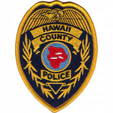
· Sherry D. Bird, Police Major, Area II Field Operations Bureau, at the Hawaiʻi Police Department.
· Edward G. Ignacio, retired Senior Resident Agent for the Federal Bureau of Investigations, former Police Officer at the Hawaiʻi Police Department and Honolulu Police Department.
· Benjamin T. Moszkowicz, Police Major, Traffic Division, at the Honolulu Police Department.
The Commission will interview the finalists, and the community can provide input at two upcoming meetings. Both meetings will start at 9 a.m. The first meeting will be held in Hilo, on Monday, Dec. 12, at the Hawaiʻi County Building, Council Chambers, Suite #1401, 25 Aupuni Street, Hilo. The second will be held in Kona on Tuesday, Dec. 13 at the West Hawaiʻi Civic Center, Council Chambers, Building A, 74-5044 Ane Keohokalole Highway, Kailua-Kona.
.jpg) |
| Dr. Michelle Reynolds and Slater, who found the fledgling endangered petrel in Hawai'i Volcanoes National Park. NPS Photo by C. Loebel-Fried |
"The ʻākeʻāke burrow was detected in the park by a really good boy named Slater of Hawaiʻi Detector Dogs, under the guidance of trainer and handler Dr. Michelle Reynolds," says the Park statement. Biologist Charlotte Forbes Perry observed the chick inside its burrow after Slater sniffed it out in September – weeks before it emerged.
"Biologists in the park have known of the presence of ʻākeʻāke on Mauna Loa since the 1990s. In 2019, ʻākeʻāke burrow calls were recorded during acoustic monitoring which indicated nesting. The lack of visual signs, like guano at their nest sites, make them extremely hard for humans to locate," Forbes Perry said. "We worked with Hawai'i Detector Dogs, and in two days, Slater located an ʻākeʻāke nest and three Hawaiian petrel nests," she said.
Forbes Perry, a biologist with the University of Hawaiʻi Pacific Cooperative Studies Unit, and her team study seabirds in Hawaiʻi Volcanoes National Park under a permit from the U.S. Fish & Wildlife Service, an active partner on the project. After Slater discovered the nests, wildlife cameras were installed to monitor the burrows.
'Ākeʻāke, also known as the band-rumped storm petrel (Oceanodroma castro), are small (adults weigh about as much as a golf ball) and are ash black with a wide white band on their squarish tail, according to the American Bird Conservancy. They nest on isolated islands but spend the rest of their lives at sea. The global population is estimated to be about 150,000 individuals, with about 240 pairs known in Hawaiʻi.
Threats in Hawaiʻi include predation by non-native barn owls, cats and mongoose, and disorientation from artificial lights. Like ʻuaʻu (Hawaiian petrels), and other seabirds, ʻākeʻāke fly to their breeding sites
 |
| ʻAkeʻāke, endangered storm petrel burrow in Hawai'i Volcanoes National Park. NPS photo |
in darkness.
Slater and trainer/handler Reynolds were also part of the team that discovered a new ʻākeʻāke burrow at the U.S. Army Garrison Pōhakuloa Training Area in early September. The nests at PTA and Hawaiʻi Volcanoes National Park are the only documented ʻākeʻāke nests in Hawaiʻi.
The ʻākeʻāke and ʻuaʻu burrows are protected within the park's 644-acre cat-proof fence and are not threatened by the current eruption of Mauna Loa volcano. People can help ensure the safety of seabirds by controlling their pets, especially cats, and using dark-sky friendly lighting. Bright urban lights disorient seabirds like ʻākeʻāke and ʻuaʻu.
The Park statement says, "While many are transfixed by the eruption that began on Nov. 27, Forbes Perry and other conservationists are equally excited by the discovery of the ʻākeāke nest. "We are ecstatic by these finds, and detector dogs are an invaluable resource to help locate these elusive birds," she said.
"Guardsmen are here to help with the increased traffic along our Traffic Hazard Mitigation Route," said
 |
| Hawai'i Army National Guard assists with traffic along Saddle Road during the Mauna Loa eruption. Photo from the Mayor's office |
"We're excited to have the Guardsmen here with us through our current response to the eruption," said Mayor Mitch Roth. "As more and more vehicles make their way through the mitigation route, it's imperative that we prioritize the safety of every person and vehicle on the roadway, which requires manpower that we just don't have on our own. Adequate response relies on the partnership, and we are honored to have great partners in our fellow State and Federal agencies who have stepped up in this time of need to be there for the Hawaiʻi Island community."
 |
| See The Ka'u Calendar in the mail and in stands from Volcano through Miloli'i. Also see stories daily on facebook and at www.kaunewsbriefs.blogspot.com |


.jpg)


.jpg)
.jpg)


.jpg)

.jpg)

.jpg)

.jpg)
